Hello folks. My name is Jim Branson and I have lived or been involved in Boise County most of my 68 years. I am going to present a virtual safari up the South Fork of the Payette River in Idaho along the area typically called Lowman to Grandjean. Some of the photos have been marked and you may need to click on them to blow them up enough to see the marks.
I was conceived as a result of Pearl Harbor when the US Government closed down the Idaho Birthday Mine at our homestead near milepost 85 on Hiway 21. Fortuitous to this historical endeavor was that my older Dad was 52 when I was born and as a child I sat around listening intently to his stories and that of his older friends like John Barr (old cabin at Chapman Creek) and John Penrod (Warm Springs Airport homestead).

John Barr had a cable across the river as the original road up to Grandjean was on the north side and his cabin was on the south side where the Hiway 21 is now.
Below is a modern day cable crossing apparatus in the Atlanta area. The one John Barr had crossing the river was much smaller and though he a small man, didn’t look like I would want to cross on it.

The way these work is you put your gear in the bottom and then crawl in on your back and pull the hanging cart across the river. You can pull a rope with you if you have somebody else that also needs to come across after you make it. Or, if you have company while you are on the other side, they can use the rope to pull the empty cart back to the access side.
In the Lowman Area there was one of these at the Hoopy Jackson Place (now owned by Ray Theis Family); one at the old Five Mile Creek Bridge below the current culvert; one at Branson Drive area; John Barr’s just above the mouth of Chapman Creek and probably one at Wapiti Creek before the old bridge was built.
Of course, eventually people got real fancy and built an occasional bridge. The orginal Jordan Bridge was constructed with a log and rock pier in the middle and A-frame log construction for the span. It was built for wagons and horses so was a tad narrow for modern vehicles.
After Ed and George Casner cleared off the Ten Ax Homestead (using primarily a No 10 axe), they wanted a little better access than the cart. They went in with the owner of the Seven Peaks Ranch (Richard’s Creek) and constructed a cable suspension bridge shown below with half sister Janet. The primary support cable was almost 2 inches but the angle was so slight that it worried people about snow build up in the big winters we had back then. Lee Winn, owner of Ten Ax in the 1950s wouldn’t take his big truck across when it was loaded with cattle. We had to pull him out of the river once when he was trying to ford the river and got stuck.

The Casner boys were real mountain men. You can still see the major ditch they built from the hot spring in Ten Mile Creek down onto the homestead on the east end. They carved it out of solid rock in places and it still shows today. A major portion of getting an approved homestead was getting irrigation water onto the property. The Ten Ax also had a ditch into Richard’s Creek. One time the water in that ditch was soaking into the ground, so we took over some of the slimy mill tailings and dumped them in the ditch and it helped seal it up for Lee Winn.
My Dad Joe was quite the axmen too and we helped Lee Winn build the log cabin still used by some Winn decedents today. We also helped Lee drain some of the swamp land using Ditching Powder. This was a higher percent nitro powder and you only put a blasting cap in the first stick and the concussion set off the rest. It sort of painted the trees with mud but it made a fine ditch where even a backhoe would have trouble today. We also blasted a many of stumps, sending some of the pieces fairly close to the older cabins. One large chunk landed about 10 yards from the old outhouse.
The hole one digs under a stump is called a coyote hole and is dug with a shovel down deep enough that the blast force pushes the stump up and breaks the tap root. Joe would cut the dynamite in half and tamp it with the handle of the shovel. After the experience with the ditching powder I was a little worried that his aggressive tamping might set it off. Dad, never missing an opportunity to mess with a troubled mind, said, “No problem, Dave (he called me by my middle name, given after his dad Dave). It takes almost 7 pounds per square inch to set it off.” I asked how much pressure he thought the handle was exerting? He said, “Not much over 5 or 6”. This didn’t help my feelings but later he explained that normal dynamite has lower percent nitro and is pretty hard to set off from pressure. He said he didn’t think shooting into a box would be a good idea.
Lee Winn and my Dad Joe spent quite a bit of time together so I was able to listen in on all kinds of stories from past. Lee took a shining to me and told stories about me regularly to visitors. Lee had the grazing rights in the area on the USFS lands and the cows roamed all over the place. One had the misfortune of one getting into our spring and got stuck and died. We drank the water for two weeks before the cow was discovered from the birds circling overhead. After that I was commissioned, with Lee’s blessing, to chase the cows out of our area. I loved it so much I would ride my bike down the river and find the cows and drive them up to the homestead and then report to Dad that the cows were here and he would tell me to chase them out of here.
One time I expanded my challenge to chase the cows on the other side of the river. I needed to take my bike over too, so I was sitting on the bike pushing with my feet and going down current in the river at the Old Point Area where the Hannan House washed out in 1974. Lee happened to be already on that side and was afraid I was drowning. At the time I was mostly submerged and the bike totally covered. Then when the bike appeared on the shore he about busted a gut and told everybody that story for years.
I had then and still have today a large sling-shot made out of 5 foot leather shoe laces (like the David and Goliath story) in which I could send a rock about half the size of a tennis ball whirling and making an eerie sound to explain to the cows why they should move on. Some of the range cows get a little mean being out by themselves for long periods of time and particularly if they had calves around.
The Idaho Birthday Mine
Joe Branson was born in Pagosa Springs, Colorado and lived on a ranch just few miles east along the San Juan River. In 1910 they sold out and moved what they could to Boise and landed in the Grimes Pass Area of Grimes Creek about 2.5 miles upstream from the Golden Age Mine Area. Grandpa Dave was in the heavy hauling business and had some work horses. He built a ditch out of Grimes Creek and cleared about two acres for large irrigated garden. Grandma Irene was a good cook and canned their winter food each fall. They pretty much lived off the land as trucks came along and put the heavy hauling with horses out of business except for the steep or muddy roads.
Joe Branson was born in Pagosa Springs, Colorado and lived on a ranch just few miles east along the San Juan River. In 1910 they sold out and moved what they could to Boise and landed in the Grimes Pass Area of Grimes Creek about 2.5 miles upstream from the Golden Age Mine Area. Grandpa Dave was in the heavy hauling business and had some work horses. He built a ditch out of Grimes Creek and cleared about two acres for large irrigated garden. Grandma Irene was a good cook and canned their winter food each fall. They pretty much lived off the land as trucks came along and put the heavy hauling with horses out of business except for the steep or muddy roads.

Grandpa Dave Branson is with his work horses for heavy hauling. House below on Grimes Creek with foot powered grinder for sharpening axes, etc.

 Grandma Irene Branson’s major garden irrigated out of Grimes Creek. They never qualified for a homestead because they didn’t have the money to file, survey or clear the minimum required area which I think was about 20 acres at their time.
Joe had marital problems with my brother Stan’s mother and after the divorce came to live temporarily with his folks at Grimes Creek, some call it Branson Flats in modern times. He decided to take a fishing trip up into the Lowman Area and he had a special place he liked to camp and special holes where he could see some big fish. In 1935 around May 16th, his birthday, he had an exceptional day fishing and caught a big one up above the modern Warm Springs Guard Station. Back in camp and the fish cleaned, he decided to do some prospecting up on the hill above where I live today. The campground was along the river on private land he later owned but nobody minded in those days.
To make a long story short, he discovered some old tunnels and concluded they had missed the ore in their endeavor. He brought back some samples and used the hand mortar to crush them up and pan them right where he had cleaned the fish earlier. To his surprise they panned really good gold with fairly good silver too. That is how the word Birthday got into the mining adventures.
His original pan and hand crushing equipment is shown below.

The gold is very finely deposited in the hairline fractured quartz. Water at great depth is also at great pressure and temperature and can absorb greater quantities of minerals just like the atmosphere can absorb more moisture at the higher pressure of sea level. As the water and air rise in elevation, the pressure reduces and less absorbed materials can remain in the water and it precipitates out into the cracks in the quartz. Over a long period of time the concentration of gold builds up in the quartz veins.
If you want the small gold particles to fall free and be heavy enough to come out in the gold pan, the quartz must be pulverized into very fine particles, perhaps a large percent in the 100 mesh size (100 divisions per inch). This can take a fair amount of time and effort in a hand heavy metal mortar and bar to get it fine enough. A typical panning result for say two pounds of ore that runs 1 ounce per ton would be 0.001 ounce per pan. If it takes 20 minutes to make a round trip, then in 10 hours you would have 0.03 ounces of gold and at $1400 per ounce that would be $42 in modern prices, or $4.2 per hour. In old times the gold was worth $35 per ounce and it would be worth $1.05 and wages at the time were about $2-$3 per day and days were long. Of course, if the gold values averaged 3 ounces per ton, then you could make wages that way.
Getting the gold out of the pan was traditionally done with mercury which attracts the gold and silver and makes an amalgam that can be heated and the free mercury condensed away leaving just the Dore material. That’s how the answer developed when somebody asked how you were, “Everything is hunky dore”, meaning you had a hunk of dore at your disposal.
But one can see with any type of enhancement of operating speed such as a powered grinding circuit even if powered by water or mule, the tonnage could be upped by a factor of ten or more.
Joe Branson was in Seventh Heaven. He was doing what he liked doing and had the potential to make a fortune and lived in an area where he could hunt, fish and prospect until hell froze over. Of course, hell did freeze over when the Japanese bombed Pearl Harbor and WW-II broke out.
Without work in the Lowman Area, Joe was forced to find some work. He got a job taking care of the hydro-electric plant for the mines in Charlotte Gulch but the plant was on Grimes Creek just above the grandparent’s place. This in 1942-1943 winter is where I spent my first year of existence and my brother Jerry and Sister Jo were a few years older and remember the details much better. Dad drove 170 feet adit another mile up the creek on the Carlson Claims. He was a blacksmith and sharpened his own steel in a forge and did the whole thing with what is called “single-jacking”. These are a progressively longer steel chisels that you hold with one hand and smack with a 4 pound hammer in the other hand. This is really hard bone jarring work. You can do about 3 feet every other day. He did most of the mucking into a wheel barrow. There is a photo below in the blacksmithing section.
After that winter everybody was trying to help with the war effort and Dad had heard of the opportunity to taken hydraulic training in Spokane and then go down to Long Beach, California to work on the base repairing aircraft landing gear systems. Off we went for a few years.
Dad and others figured out how to use Sego Concentrated Milk to put the rationing stamps on and then you could remove them and use them again. So he was able to drive from Long Beach back to Grimes Creek and check on his mother who now was living alone since Dave had died in 1937. Her good friend Sterling Alley (later had a sawmill in Garden Valley) used to ride up on his horse as a teenager and hunt the area and give some of the meat to Irene for canning. He also cut and split wood for her. She in turn would cook and bake for him and send him home with her specialty goose berry pies.
The photo left is a digital fuzzy copy of an old photograph of the mill put in around 1936. They drove a 270 foot tunnel and cut the ore at a depth of about 100 feet. They shipped ore containing over 1000 ounces of gold and 800 ounces of silver. The mill was relocated to Nevada in 1951. The open door is where the jaw crusher was located and there was a screen deck, ball mill, shaker table and flotation cells in the process. The chute on the right was where the “as mined and sorted ore” was shipped direct without milling. This ore average 1.33 ounces per ton gold.
Without work in the Lowman Area, Joe was forced to find some work. He got a job taking care of the hydro-electric plant for the mines in Charlotte Gulch but the plant was on Grimes Creek just above the grandparent’s place. This in 1942-1943 winter is where I spent my first year of existence and my brother Jerry and Sister Jo were a few years older and remember the details much better. Dad drove 170 feet adit another mile up the creek on the Carlson Claims. He was a blacksmith and sharpened his own steel in a forge and did the whole thing with what is called “single-jacking”. These are a progressively longer steel chisels that you hold with one hand and smack with a 4 pound hammer in the other hand. This is really hard bone jarring work. You can do about 3 feet every other day. He did most of the mucking into a wheel barrow. There is a photo below in the blacksmithing section.
After that winter everybody was trying to help with the war effort and Dad had heard of the opportunity to taken hydraulic training in Spokane and then go down to Long Beach, California to work on the base repairing aircraft landing gear systems. Off we went for a few years.
Dad and others figured out how to use Sego Concentrated Milk to put the rationing stamps on and then you could remove them and use them again. So he was able to drive from Long Beach back to Grimes Creek and check on his mother who now was living alone since Dave had died in 1937. Her good friend Sterling Alley (later had a sawmill in Garden Valley) used to ride up on his horse as a teenager and hunt the area and give some of the meat to Irene for canning. He also cut and split wood for her. She in turn would cook and bake for him and send him home with her specialty goose berry pies.

The photo left is a digital fuzzy copy of an old photograph of the mill put in around 1936. They drove a 270 foot tunnel and cut the ore at a depth of about 100 feet. They shipped ore containing over 1000 ounces of gold and 800 ounces of silver. The mill was relocated to Nevada in 1951. The open door is where the jaw crusher was located and there was a screen deck, ball mill, shaker table and flotation cells in the process. The chute on the right was where the “as mined and sorted ore” was shipped direct without milling. This ore average 1.33 ounces per ton gold.
The war finally got over and we all moved back to Grimes Creek, renting a vacant cabin at the Golden Age Mining Camp. My birthday was just a little past the cutoff, so I didn’t start school until almost seven years old. In those two years prior, I was Dad’s continuous companion and went everywhere with him. I almost came to an abrupt end when the ground gave way and I fell down behind a bulldozer that was backing up. Dad caught the driver’s attention just in the nick of time. This ended my close watching of the bulldozer. I always loved machinery, particularly bulldozers, and likely the reason I became a mechanical engineer.
I remember going to Nevada with him to look at some mining properties and he cautioned me not to eat with the folks because they were using jack rabbits in their stews. As I remember we took a “black light” to look for tungsten.
The war ended in 1945 and it wasn’t until 1950 that the Birthday Mine got restarted. The plan was to drive a new development tunnel about 2000 feet to cut the ore at about seven hundred feet deeper. The primary investor in that phase was Pierre DuPont III.
From 1950 to about 1953 it was just a matter of finding miners and keeping things going. The DuPont family would come out and visit in the summer and combine some work with pleasure, doing some sight seeing, fishing and other recreational activities. These folks were billionaires but were quite friendly and would sit on DuPont empty powder boxes around the expanded dining table.
Jim got trained as a miner in 1956. The photo below demonstrates why you should get the track switch all the way closed before taking a car out to dump. Dad had gone to get the mail (12 miles away) and I dumped this car in the middle of the track. I knew the other miners were expecting me to get the blasting primers put together and get back inside. So I reloaded all the muck back into the car, dumped it and got ready to go back. Martha took this picture as I was finishing up.

The little compressed air tram below is what I was driving to haul the muck out of the tunnel. There was a compressed air powered mucking machine and drilling machine inside. Everything ran off the reciprocating 210 scfm Gardner Denver air compressor.

I made about $850 working at $1.75 per hour which was a ton of money for a kid almost 14 years old. Dad had me pay Martha for room and board so she benefited to some degree also. I bought some of the ugliest clothes humans have ever seen but otherwise didn’t spend it all immediately. I had a checking account at the First National Bank when you could still right checks at a restaurant with counter checks.
There was a major fight between the promoter Charles Woodward and Joe Branson the founder and mine superintendent. Woodward forced the tunnel to take a bend right before it was going to cut the ore and Joe went crazy with anger. Finally Joe contacted DuPont directly and got funding for the Branson Development Tunnel. They core drilled up at an angle to hit the ore sooner and hit it right where Joe thought it was. They drove the tunnel and hit the ore and then DuPont figured he was getting too old to run an operation where the two key people hate each other. The mine was returned to Joe Branson for $1 and the homestead sold to him for $3000. Dad sold the timber off the lower portion and paid back the loan he had and bought a new 4wd Jeep pickup. Since he was over 65, he started drawing social security and veteran benefits and didn’t really have to work.
Mount Borah Hike
It has taken a long time in this virtual journey to get to this point, but this is how Jim became so well versed on the South Fork of the Payette River. From 1956 to 1961 Jim became the packhorse for the Joe Branson Prospecting Agenda. I don’t think there is any drainage that I have not been up several times. Dad was small, wiry and a blacksmith. He could lift a hundred pound anvil with one hand. If he got a hold of you anywhere, it really hurt. I was six feet tall and a bit skinny. I remember working out on weights trying to get up to 175 pounds even in my last year of college. Now I can gain weight just looking at food.
Of course, I didn’t have a camera and digital cameras were not even dreamed of. So a lot of my pictures are in modern times when hiking is not nearly so easy when you are 40 pounds overweight. But I have always had super strong legs and can still get around pretty good at 68. When I was seriously overweight a decade back, I rode my mountain bicycle from milepost 85 up over Banner Summit and down to the Bear Valley turnoff. Then up over Cape Horn Summit and down Fir Creek to Bruce Meadows. Then up Bear Valley Creek over Horse Creek Summit and down Clear Creek Road to the intersection of Hiway 21 and 17. A total distance of 70 miles….all in one day. Of course, I started at 5am when all I could see was the white line on the edge of Hiway 21.
In 2005 I got my weight down to something reasonable and climbed Mt. Borah, an elevation change from about 7500 feet to over 12,500 feet. I have climbed 3000 to 4000 feet elevation many times in one day, but 5000 feet is too much for a 63 year old in one day. The famous Chicken Out Ridge is actually sort of serious mountain climbing.

The first photo below is past the worst part of the climb. I was really happy to link up with the Boy Scout troop. Some of the tough areas are not marked well and you end up retracing. One scout was a regular mountain goat and had already hiked to the top and came back to help his buds. He coming down made it clear where the main trail was.

You might ask why I didn’t take pictures thru the main rock climb on Chicken Out Ridge which is the area between the two photos? The answer is simple. Your hands are both busy hanging onto cracks and getting your feet into the other cracks. It is a shear drop off of 3000 feet to the first bounce. Not a time to be taking pictures. If I get stupid again, I will take pictures of that section.
Up on top there were so many boy scouts and I was afraid of rolling rocks so I cut short of them. I knew I was way over tired and had a major effort getting down. I didn’t realize that a fat man coming up rests regularly because of the air. Going down one need be sure you rest more often because your legs can get campy and end your hiking day.
When I got into the car I was relieved. When I stopped in Challis to get some snacks, I was welded to the seat and could not really get out and fill the car. I hired a kid with somebody else to go in and buy some snacks and fill my car for me. When I got home, it took over a half hour to get inside and into bed. My dog Ami thought I was dead on my feet….I did too.
The marked trail below looks much worse than it is. The mountain is sloping away from the camera so it is not as steep as it looks.

Hiking with my Dad was not nearly so rigorous as the Mt. Borah hike, particularly since I was only 170 pounds at that time. But the hike down in the old days was a bit tougher since I would have up to 40 pounds of prospecting samples.
In 1960 when my Dad was 70 we hiked from the now Grandjean Campground up the SF of the Payette to Baron Creek, up Baron Creek to the North Fork of Baron and on up to Sawtooth Lake and back out in one day. And this was before the trail was built.
I went up to the same area in 2008 and did some trail work. You can see the hand saw and Pulaski in the photo below. That is my tent I bought to keep bugs off the dog but I didn’t have a dog that year. The cross cut saw is not as fast as a chainsaw but sure is a lot lighter and easier to pack. Of course, chainsaws are not allowed in the wilderness.

This trip was jolted by a beautiful young girl coming down the trail and asking if I knew where Sawtooth Lake was located. I explained that Sawtooth Lake was where she came from and that she had a 2000 foot climb to get back up there. She had come up to Sawtooth Lake and saw a sign, “McGoran Lake ->” and didn’t notice the arrow. So she thought that Sawtooth Lake was McGoran Lake. Why she hiked 5 miles down the North Fork of Baron Creek looking for a large lake when you can see the whole valley from the top, is beyond me. 
After she departed I looked down and saw her sliding over a wet slippery log instead of wading the shallow creek, I about crapped. But she made it just fine. Too bad…I was perfectly willing to share my tent and sleeping bag with her and let her try it the next day. I even offered some of my Mr. Boston rum mixed with Gatorade….but didn’t help much.If you are planning to hike this route, you want to be careful at this crossing too early in the season. You can see below the log that the current is swift and gets worse below that area. You would never get out even without a pack.

After she departed I looked down and saw her sliding over a wet slippery log instead of wading the shallow creek, I about crapped. But she made it just fine. Too bad…I was perfectly willing to share my tent and sleeping bag with her and let her try it the next day. I even offered some of my Mr. Boston rum mixed with Gatorade….but didn’t help much.If you are planning to hike this route, you want to be careful at this crossing too early in the season. You can see below the log that the current is swift and gets worse below that area. You would never get out even without a pack.
Lots of people like this hike from the Iron Creek Trailhead a few miles west of Stanley up past Alpine Lake (there are lots of Alpine Lakes) and onto Sawtooth Lake. The trail goes on around Sawtooth Lake and then down the North Fork of Baron to the main Baron Creek. You can then hike up Baron Creek past Baron Falls and see some spectacular scenery around the Baron Lakes. 

One can see that even in late July there can be some serious snow at Sawtooth Lake. This is Regan Peak and its dome shaped top is a major landmark for locations on the other side in the Baron Creek drainage. 
Below is the trail looking over into the North Fork of Baron Creek. That is my dog Ami who loved hiking….loved people….especially women and children….but…ate other dogs so I generally had her on a leash. In this area this time of year there are not many hikers.

On the way out we met people with two big labs who were not on a leash and came running up to her. I couldn’t hold her and she chewed the crap out of both of them. I never worried about wolves with her unless there was a whole pack of them. Only problem is, if she was in the tent and something came thru camp, she wouldn’t open the tent door and we sort of had to start the tent process all over again.
The picture left is the view down the North Fork of Baron Creek about 2 miles above my work camp shown above. I was happy to have cleared the whole trail on this trip.

Below is the trail looking over into the North Fork of Baron Creek. That is my dog Ami who loved hiking….loved people….especially women and children….but…ate other dogs so I generally had her on a leash. In this area this time of year there are not many hikers.


On the way out we met people with two big labs who were not on a leash and came running up to her. I couldn’t hold her and she chewed the crap out of both of them. I never worried about wolves with her unless there was a whole pack of them. Only problem is, if she was in the tent and something came thru camp, she wouldn’t open the tent door and we sort of had to start the tent process all over again.
The picture left is the view down the North Fork of Baron Creek about 2 miles above my work camp shown above. I was happy to have cleared the whole trail on this trip.
The trip up the main Baron Creek can be started from the Grandjean Campground. It is about 1.25 miles up to Baron Creek and then about 2.5 miles up to the North Fork of Baron Creek crossing. There is a nice foot log there but if the creek is high, water can splash up on it and make it slippery. Course, if the water is high, you are not going to get all the way to Baron Lakes without serious snow.

This lady and son are related to a friend of mine and they wanted a quick day hike up Baron Creek and this is the log crossing the creek in low water. 

The good news if you go early is that Baron Falls have a lot more water in it. This picture is taken in late May and is about as good as it gets for water flow.

The picture left is of the trail as it climbs up the last section before the top of the falls. It is a pretty hard climb for horses but many have made it just fine. Down is a little scary.

The picture left is of the trail as it climbs up the last section before the top of the falls. It is a pretty hard climb for horses but many have made it just fine. Down is a little scary.
Of course, the bad news is that you can’t get there safely. This is Jami who was still a pup and I was worried she might get into the channel on the right where you would be swept down over the falls in a fast moving channel. Not a place to let kids go ahead by themselves. 
The photo below is from the huge rock outcrop just above the falls looking down the main Baron Creek. The North Fork comes in about where the canyon bends to the left.

The photo below is from the huge rock outcrop just above the falls looking down the main Baron Creek. The North Fork comes in about where the canyon bends to the left.

The day hike is about 8 miles each way from Grandjean Trailhead to a place above the falls. If you don’t have a pack that is not all that difficult for somebody fit enough. I generally clear a little trail and piddle around up there in the spring because there is only one major high water crossing and that is NF Baron with a good log. That crossing is a little tough on horses because there are so many big rocks where the trail fords the creek. A girl drowned at that place because she didn’t take her pack off while wading and could never regain her footing after being knocked off balance.
There is a good place to pitch a tent and camp right above Moolack Creek. After that the trail leaves the creek and there is not much in camping until you get above the falls.
You see various groups if you hike in the main part of the season after the snow goes away. The horses and lady tender are part of Daryl Alloway’s outfitting business located at the Sawtooth Lodge area and he provides packing services to the public with notice. In this case he was packing in hay to Baron Lake for stockpile for the Horseman Association. It is also a way to train the newer horses for future activities.
There is a good place to pitch a tent and camp right above Moolack Creek. After that the trail leaves the creek and there is not much in camping until you get above the falls.
You see various groups if you hike in the main part of the season after the snow goes away. The horses and lady tender are part of Daryl Alloway’s outfitting business located at the Sawtooth
 Lodge area and he provides packing services to the public with notice. In this case he was packing in hay to Baron Lake for stockpile for the Horseman Association. It is also a way to train the newer horses for future activities.
The group below camped near me above Moolack Creek and were destined to make the loop around Krammer Lakes and back down the South Fork of the Payette.

The trail crosses the outlet of the lower Baron Lake that you first directly encounter on the trail. The lake is accessible all around it. I have seen many fish caught and released up there. Some folks cook them up. Most of the hikers camp on the trail side if they are going on to higher country. Folks that are going to stay awhile, move around the lake to the south side. There is not a prepared trail but it is easy walking. 
The outfitter packs in large parties with alcohol so it can get a bit party-mode in their area and of course the horses bring in the horseflies and deerflies. I always carry a can of bug spray and a 38 S&W for settling disagreements.
The picture below is the upper Baron Lake and is not nearly so camp friendly but has a lot less people in the busy part of the season. These pictures were taken in early July and the main traffic from Redfish Lake had not begun the adventure because of the snow.
One can see below that the trail is fairly clogged with snow at least July 10, 2008. I did hike up thru it and some other folks did too. But since I was on a day hike from my camp at Moolack  Creek I was beginning to run out of legs.
 Creek I was beginning to run out of legs.
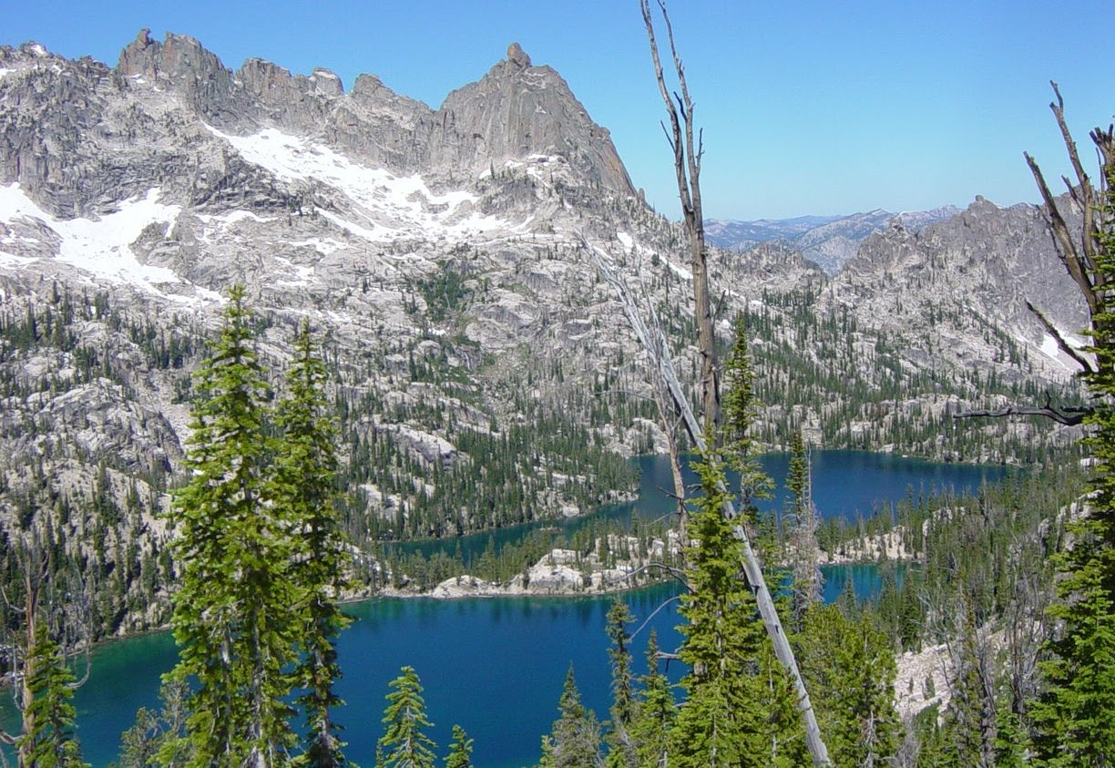
The view below is from the summit looking towards Krammer Lakes along the Redfish Lake Creek  drainage. Redfish Lake is out of sight to the left of the lakes below the summit. There is still enough snow to discourage hiking up from that side. Most of the people I talk to leave their car at Redfish Lodge and have somebody drive them to Iron Creek Trailhead and then make the loop up Iron Creek to Sawtooth Lake and down NF Baron and up Baron Creek to the lakes returning finally over the summit to Redfish Lake.
 drainage. Redfish Lake is out of sight to the left of the lakes below the summit. There is still enough snow to discourage hiking up from that side. Most of the people I talk to leave their car at Redfish Lodge and have somebody drive them to Iron Creek Trailhead and then make the loop up Iron Creek to Sawtooth Lake and down NF Baron and up Baron Creek to the lakes returning finally over the summit to Redfish Lake.
Below one can see what it looks like looking from Redfish Lake up towards the inlet end and the Sawtooths to the NW of War Bonnet Summit. You can see the reason for making the loop that way as the scenery is spectacular. 

Photo below is of Hidden Lake and The Temple in the background. Krammer Lakes are over a summit to the left of Hidden Lake. You can see the pass at the left of the photo. This picture is from a different hike in 2006 when I about got killed with a forest fire. 
I had hiked into Elk Lake from the Grandjean Trailhead with a 45 pound pack about 12 miles. Pretty tough hike for an old overweight dude. But the next day is when stupid boiled up in my drinks. I took off and hiked up the SF past Smith Falls and on up past Benedict Creek and clear to Hidden Lake. One way about 9 miles and far too far even without a pack on the second day. But limping my way back, I figured to do nothing on the third day and hike out casually on the fourth day.

I had hiked into Elk Lake from the Grandjean Trailhead with a 45 pound pack about 12 miles. Pretty tough hike for an old overweight dude. But the next day is when stupid boiled up in my drinks. I took off and hiked up the SF past Smith Falls and on up past Benedict Creek and clear to Hidden Lake. One way about 9 miles and far too far even without a pack on the second day. But limping my way back, I figured to do nothing on the third day and hike out casually on the fourth day.
Below is Smith Falls right below the entrance of  Benedict Creek. This is a beautiful area and there are some major fish below the falls. Elk Lake just a mile or so downstream is a good feeding ground and then the fish run upstream to get the “big bugs” coming over the falls. Spray from the falls often knock bugs into the water right out of the air.
The USFS trail crew also camp in this area and have major horses, so if they are there, you will want to camp somewhere else. The river crossing below is fairly flat and not much current. The trail forks right above this area with a major trail going to Benedict drainage and the other up the SF Payette to the loop of lakes at the head of the river. There is something about falls that is very peaceful to me.
 Benedict Creek. This is a beautiful area and there are some major fish below the falls. Elk Lake just a mile or so downstream is a good feeding ground and then the fish run upstream to get the “big bugs” coming over the falls. Spray from the falls often knock bugs into the water right out of the air.
The USFS trail crew also camp in this area and have major horses, so if they are there, you will want to camp somewhere else. The river crossing below is fairly flat and not much current. The trail forks right above this area with a major trail going to Benedict drainage and the other up the SF Payette to the loop of lakes at the head of the river. There is something about falls that is very peaceful to me.
The picture below is Benedict Creek coming into the SF Payette River above Smith Falls. It is a huge rock face under the water and wore smooth with erosion. People tend to get naked and slide down this when it is hot. Sort of like having fun while taking a bath. Unfortunately I didn’t get a picture of the people who streaked out of the area when they saw me coming close enough for a photo.

Below is Elk Lake which is a bit marshy these days.


Below is Fern Falls which is right below Elk Lake and is a welcome sight when hiking into Elk Lake. The earlier in the season one goes into the area, the higher the water pace and more exciting the falls. Of course, snow is problem at the higher elevations. 

So after returning to camp dog tired on the second day, I awake the third day and smell smoke with no campfire or forest fire in sight. The smoke seems pretty intense and I know it could be the fire is between me and my car and I don’t have enough grub or legs to hike out the other side.
So I decide that I will hike down to Big Meadows where I know I can see down the canyon and see what is happening. If there is no danger then I will camp and rest up for the rest of the day.
When I get to Big Meadows, I see the fire below, though the picture is taken from outside the fire on the road below Grandjean. I can see hot cinders coming over from Trail Creek onto the trail between me and the car. I know I have to push my way on out in case the fire jumps into the SF Payette River.
This is when I killed my Achilles Tendons and about ended my hiking career. By pushing hard for another six miles when I was already dead on my feet, I did damage to the tendons and it took several months with the help of some boot inserts to get over it. 
As experienced as I am in mountain affairs, I sure didn’t plan for this. It just goes to show that one should never wear themselves completely down just in case some emergency comes up.
Below I am backing up a little to cover the SF Payette Loop which covers the upper lakes. The easiest way to get there is up past Yellowbelly Lake from the Salmon River side. Ms Ami is a real chick magnet. Unfortunately, this chick came with her own support dude. Ami seldom barked at anything….when a girl or kid was around, she just started wagging that huge tail of hers. This girl named Heather loved Ms Ami.

The picture below is Edna Lake on the head of the SF Payette taken from our campsite where Heather met Ami.
The picture below is Edna Lake on the head of the SF Payette taken from our campsite where Heather met Ami.


As experienced as I am in mountain affairs, I sure didn’t plan for this. It just goes to show that one should never wear themselves completely down just in case some emergency comes up.
Below I am backing up a little to cover the SF Payette Loop which covers the upper lakes. The easiest way to get there is up past Yellowbelly Lake from the Salmon River side. Ms Ami is a real chick magnet. Unfortunately, this chick came with her own support dude. Ami seldom barked at anything….when a girl or kid was around, she just started wagging that huge tail of hers. This girl named Heather loved Ms Ami.

The picture below is Edna Lake on the head of the SF Payette taken from our campsite where Heather met Ami.

The picture below is Edna Lake on the head of the SF Payette taken from our campsite where Heather met Ami.


Ms Ami never complained and loved being out in the mountains. It was this hike that taught me to get a tent so she could get bug-free at night. After spending the night here her eyes were almost swollen shut. 
That is Snowypeak in the background. It is well over 10,000 feet. It is on the divide between the SF Payette and the Middle Fork of the Boise River drainage. There are tons of lakes all over the whole area.
The picture above is Ms Ami looking over Toxyway Lake at sunrise.

That is Snowypeak in the background. It is well over 10,000 feet. It is on the divide between the SF Payette and the Middle Fork of the Boise River drainage. There are tons of lakes all over the whole area.
The picture above is Ms Ami looking over Toxyway Lake at sunrise.
It is now time to exit the Sawtooths for a while and check out some more of the SF Payette Areas that are readily available from the Boise side.
Eightmile Creek
Eightmile Creek comes into the SF Payette just east of my homestead. There was a major trail up the creek built in the CCC days for fire control. Yep…people actually hiked to the fires, even in the dark, and actually tried to put the fire out. Hard to believe, don’t you think? The trail still is clearly marked and remarkably accurate on the old USGS maps. If you go online, you need to get down to the highest magnification before the trails show. The USFS refuses to acknowledge the trail and no longer maintains it.
I have kept working on the trail over the years and have only had to re-route it in a few small areas along where the animals had already blazed the way. Since I was up the trail many times when it was maintained, I have no problem following it. It is much easier to cut out the trees with chainsaws and not much work has been required for dirt moving except a recent earth slide just below the West Fork. The outfitter has re-routed the trail in two crossings below and above, but those crossings are pretty hard to get across in high water on foot.
Since the trail is close to my home, I go up there often and many different times of the year. The lakes around Red Mountain are about 14 miles so a day hike is out of the question. Besides, those lakes are more easily accessed from the Red Mountain Trailhead on Clear Creek. It is only about a 5.5 miles hike into the lakes and it is a non-motorized trail.

Not the photo you were expecting in Eightmile? This is Doc, brother of Jami and owned by Ron and Carol Loux. He hikes with me since Jami died in 2008.
Well, I guess you probably feel I like Eightmile because of the memories. Yep….that would be true. But here is proof that I was skinny once. This is Red Mountain Lookout where I was on station the summer of 1961, fresh out of high school and doomed to go to the University of Idaho that fall. But I made about $1000 and you sure don’t spend much on a lookout. I paid all expenses coupled with jobs I had on campus.
My Dad is the ghost in the door way. He hiked in with Martha and Janet and brought me a watermelon (I loved watermelon). I offered him some and he said, “You think I carried that sob in here for me to eat some of it?” The hike is about 4 miles and changes elevation about 4000 feet. For a dude 71 years old, a fairly good hike. They hiked back out the same day. He did come up one other time by himself and stayed overnight. A lightning storm came up and struck the lookout several times. I never had seen my Dad afraid of anything….man or beast….but he was one scared dude that night. I was too the first few times. Unless you have experienced it, you don’t realize what lightning can do on the surface before the strike happens.
Below are views from Red Mountain Lookout after they burned it down. It is early in the season so two of the lakes are still frozen. The view of the Sawtooths is awesome. That is the head of Eightmile at the bottom of the picture.


Below is a huge rock just above the mouth of the West Fork. Looks like my neighbors.

Well, I guess you probably feel I like Eightmile because of the memories. Yep….that would be true. But here is proof that I was skinny once. This is Red Mountain Lookout where I was on station the summer of 1961, fresh out of high school and doomed to go to the University of Idaho that fall. But I made about $1000 and you sure don’t spend much on a lookout. I paid all expenses coupled with jobs I had on campus.
My Dad is the ghost in the door way. He hiked in with Martha and Janet and brought me a
 watermelon (I loved watermelon). I offered him some and he said, “You think I carried that sob in here for me to eat some of it?” The hike is about 4 miles and changes elevation about 4000 feet. For a dude 71 years old, a fairly good hike. They hiked back out the same day. He did come up one other time by himself and stayed overnight. A lightning storm came up and struck the lookout several times. I never had seen my Dad afraid of anything….man or beast….but he was one scared dude that night. I was too the first few times. Unless you have experienced it, you don’t realize what lightning can do on the surface before the strike happens.
Below are views from Red Mountain Lookout after they burned it down. It is early in the season so two of the lakes are still frozen. The view of the Sawtooths is awesome. That is the head of Eightmile at the bottom of the picture.


Who likes mountain scenery, anyway? This is the Doctor and middle lake is behind him. 
Below is one of the lower lakes more readily available to campers and horse folks. There are fish in this lake….how do I know when I don’t fish anymore? Well….the Doctor can see fish….he can’t see much else….but he can fallow fish underwater. I will show him in a movie later. Of course, I can see the fish too.

Below is one of the lower lakes more readily available to campers and horse folks. There are fish in this lake….how do I know when I don’t fish anymore? Well….the Doctor can see fish….he can’t see much else….but he can fallow fish underwater. I will show him in a movie later. Of course, I can see the fish too.

Below is Haus, brother of Ami, who is guarding the beer on a hike up Eightmile Creek. A snow slide was kind enough to provide some cool down time.


One just doesn’t realize how important it is to train the big dudes to guard the beer.
Above shows the slide that erased the trail in a short section below the West Fork. I have cut a new trail across but it is still not horse-worthy. Trail marked in red.

Above shows the slide that erased the trail in a short section below the West Fork. I have cut a new trail across but it is still not horse-worthy. Trail marked in red.
Eightmile becomes a fishing stream if you get above where the USFS sprayed DDT in the 1950s for the Tussock Moth and killed important underwater bugs that keep the fish alive in hard winters.
Hot Springs in Lowman
There are several large hot springs on the SF Payette in the Lowman Area. They start down in GV at the campground just above the airport. Then there is one at Pine Flat. But the most notable ones are at Kirkham Creek, Warm Springs Creek and Sacajawea just below Grandjean. There is a small one up Ten Mile Creek above the end of the road about half a mile.
There is a lot of science that goes into hot spring management. It is not hard to burn one side of your body and freeze the other side. The trick is to get the water mixing well upstream and make a nice cozy place to sit and sip suds. Older folk with more spending money should take plenty of beer to attract young things with few clothes. The more they drink, the friendlier they get, I have heard.
The scene below is Bonneville up in Warm Springs Creek about a mile from the Hiway 21 entrance. You can see the major dams and diversions folks have built. The small building is a wooden bathhouse complete with tub for those seeking privacy. You can adjust the water temperature with a cold water spout.

Below is a photo of Kirkham in low water and represents a far more hospitable recreational opportunity.
The photo below is of Sacajawea in spring time when the snow is still on. You can see Grandjean Peak in the background. This hot spring is just down river a half mile from Sawtooth Lodge. Again you want to be here in low water which means up to about June and then it drops off again in July.

Below is Sacajawea in spring time. The major snows haven’t started to melt yet as you can see on the mountains. 

The picture below is of the Ten Mile hot spring, lesser known but frequented by some of the Ten Ax folks, some better looking than others. 

Motorcycle Maneuvers 
I have to admit I have had a ton of fun riding the trails on motorcycles as well as bicycles. On a motorcycle you can easily cover near a hundred miles in a day, depending on how many trees you have to cut out. Below is my special bud who loved riding too. His name is Ross Fontes. He has made the SF Payette a very pleasurable place for riding. That is me on the left and Ross on the right. Cool dudes, don’t you think?

I have to admit I have had a ton of fun riding the trails on motorcycles as well as bicycles. On a motorcycle you can easily cover near a hundred miles in a day, depending on how many trees you have to cut out. Below is my special bud who loved riding too. His name is Ross Fontes. He has made the SF Payette a very pleasurable place for riding. That is me on the left and Ross on the right. Cool dudes, don’t you think?

My bike is in the foreground and Ross’s on the left. Chuck Rempes took the picture and his bike is the green one. This on the road to Graham at Tyee Mountain looking at the Sawtooths around Atlanta. The road in there now is pretty rough for anything except a motorcycle. Ross and Chuck raced on the way out and got some dirt rash for their troubles. 
Left is the Graham Guard station which I think I painted last in 1962. Chuck and Ross are on their bikes. The fire had burned through a couple years earlier. Chuck worked for the USFS and he had a key and we went inside and checked out the old map and stuff I had to do when I was the Headquarter’s Guard at Lowman District Station.

Left is the Graham Guard station which I think I painted last in 1962. Chuck and Ross are on their bikes. The fire had burned through a couple years earlier. Chuck worked for the USFS and he had a key and we went inside and checked out the old map and stuff I had to do when I was the Headquarter’s Guard at Lowman District Station.
Below is a trip up Julie Creek and Jim took a short cut over the side of the trail. Big Bad Chuck took a picture to prove I screw up now and then. 

But the good news is that you easily get up high enough in minutes to see some great sights. Below is a view of SF Payette from Baron Creek up to Big Meadows. 


The picture below is from Wolf Creek Ridge looking over Wapiti Creek up the SF Payette at a wide angle. This is only about a one hour motorcycle ride from my house.

My Place?
Maybe a few pictures from my house would explain how a mountain man can survive these days.

The left is the view of Jackson Peak with some sneaky helicopter in there. I often run into the boys up at the Warm Springs Airport when they are chasing each other around in war games. I once ran into them on the Link Trail from the airport to Red Mountain area. These happened to be the bad guys and I tried to give them insight into where they could go to escape and return to base without detection. I don’t know if they won that day or not.
I once saved Col. Juhaz from a painful virtual death at Edward’s Airbase when he was a test pilot down there. Walt Minnick, CEO of Trus Joist at the time, asked why we needed a test pilot at the machine shop and I told him Don could program those little programmable controllers that we were putting into the mills at Eugene and Junction City. He bought it. Juhaz had never seen one but I knew he could program them. He did and I was happy I did it and still happy I lied about it.
Below is the view upriver at sunrise. Why would anybody want to live anywhere else?
So why would somebody want to hike around and break their butt climbing mountains when the view at home is not too bad. The rainbow below is typical of summer scenes.

But….that’s not the big problem. It is these foolish elk and deer that keep coming around and laying it on me about getting rid of the wolves. So I did. I discovered that a 20 gauge shotgun makes a lot of noise and flame out the end in the dark and that scares wolves when shot up into a tree top. I also have a 10 million candlepower spotlight that does a number on them in the dark….particularly when followed with some shotgun sounds.
The picture below is from a video which had better resolution than the photo but shows the type of buds I have into my parlor now and then. They are around from April to about the end of June when they get horny and head up high to find the cows that have just finished raising their calves from the spring.


Not all was well in a few years past. The picture below is of a wolf kill in the yard of a local resident, Mel Alsager. Generally the wolves take down the elk and start eating it when it is still alive. The sounds are horrible and just imagine if this is your front yard and the grandkids are watching.
Below is the view upriver at sunrise. Why would anybody want to live anywhere else?
So why would somebody want to hike around and break their butt climbing mountains when the view at home is not too bad. The rainbow below is typical of summer scenes.

But….that’s not the big problem. It is these foolish elk and deer that
 keep coming around and laying it on me about getting rid of the wolves. So I did. I discovered that a 20 gauge shotgun makes a lot of noise and flame out the end in the dark and that scares wolves when shot up into a tree top. I also have a 10 million candlepower spotlight that does a number on them in the dark….particularly when followed with some shotgun sounds.
The picture below is from a video which had better resolution than the photo but shows the type of buds I have into my parlor now and then. They are around from April to about the end of June when they get horny and head up high to find the cows that have just finished raising their calves from the spring.


Not all was well in a few years past. The picture below is of a wolf kill in the yard of a local resident, Mel Alsager. Generally the wolves take down the elk and start eating it when it is still alive. The sounds are horrible and just imagine if this is your front yard and the grandkids are watching.

I am happy that I have worked hard to run wolves from my area and that the hunting season on wolves has greatly reduced the problem for the folks in Lowman. There were some eight packs that could come into the Lowman valley and kill right in the yards of the residents. I don’t believe the residents are going to put up with it in the future whether there is a legal hunt or not. The local Idaho World refuses to print pictures like the one above because they are a “family paper” and don’t want the children to see it. So I guess the Lowman residents just drill a hole in the grandkids head and let the images and terror bleed off. I have talked with elderly women who are afraid to walk from their house to the garage in the dark because of the wolf presence. I hope the wolf lovers put something on their car to identify themselves so I can help them understand terror.
Here is a much happier photo. Deer are thriving much better than the elk. Wolves love the elk because they run in a fashion for which their rear feet are very predictable when they hit the ground and can be ham strung easily. Deer are too bouncy for them.


These critters are fun to watch and they have personalities. People wonder how I can tell them apart, but actually it is quite easy. They are shedding in the spring and scratch off their old hair in different patterns and can be easily identified from day to day.

The critters below are also part of the daily life. I like to attract the fox because they kill mice, rats and other rodents. The jays eat the brown stink bugs and are very happy doing it. We don’t see a lot of moose but I have a very funny video of me chasing a young bull doing my imitation of a cow in heat sound and he finally turns around and thinks about coming back towards me. I looked around and saw an old outhouse and hoped I could get in there with just my house slippers on before he got to where I was

The critters below are also part of the daily life. I like to attract the fox because they kill mice, rats and other rodents. The jays eat the brown stink bugs and are very happy doing it. We don’t see a lot of moose but I have a very funny video of me chasing a young bull doing my imitation of a cow in heat sound and he finally turns around and thinks about coming back towards me. I looked around and saw an old outhouse and hoped I could get in there with just my house slippers on before he got to where I was

Well…..enough of the animals attacking me around the house. What kind of fun is there up in the SF Payette?
Trail Clearing

There are some other crazies up here who actually think clearing the old trails of trees is a fun thing to do. My neighbor Sid, of “Ballard, Ballard and More Ballard”….sometimes called Ballardandco, also has a desire to clear trails. He also has and likes to ride horses which come in handy if you have a huge chainsaw to carry. So we have worked together on the local trails to clear them out a bit.
Here he is below on his faithful horse Joe and cow dog Mollie on the Link Trail with the Sawtooths in the background. He was so happy we climbed up to Eightmile Mountain and cut out a log with a hand saw and found a sign that said, “Sid’s Point”. It was obviously named for somebody else since he hadn’t been there before.
Oh oh…how did this old picture get in there below? Yep…Dad invented this trail buggy and we used it to haul heavy loads up the trails. That’s me about age 11 and step mother Martha heading up Baron Creek before it was wilderness. 
Second picture is an outing up Canyon Creek before the Hiway 21 was put up there.

Second picture is an outing up Canyon Creek before the Hiway 21 was put up there.
Oh man…here is Ballard doing road work in winter….size of the toys and boys…..


This is Kim, Sid’s middle daughter who flies the high trails in a 207 now and then. She took us up on a flight but dad wasn’t particularly enthused about this aerial trail work. Back to ground trail work I guess.


We don’t always ride motorcycles. This would be a little tough on a motorcycle. One can carry the mountain bike over short stuff like this. Wood platform on the back is for a chainsaw. Rack on the front is for sleeping bags and minor pack stuff. Pack bags are for rum and Gatorade….perhaps other stuff too. Then I carry a pack on my back while riding. This is on the Red Mtn Trail over near the intersection with the Kirkham Ridge Trail in early summer.
Well…enough of this trail stuff.
Fish Stories?
In my youngest days the limit on fish was 30 a day. The old dirt road was a washboard from beginning to end. Yet people would rattle their old cars up from the Boise Valley and be parked on every little turnout they could find. Thirty to fifty cars would be typical of a weekend. People absolutely loved the fishing and we couldn’t have been the only ones who caught a bundle now and then. Below is a catch when I am old enough to catch some myself. I apology for the quality of the photo but you get the idea. There appears to be about two dozen little ones and 17 bigger ones.


Below is Chuck Rempes doing trail work on the Warm Springs Trail when we were on motorcycles.


We don’t always ride motorcycles. This would be a little tough on a motorcycle. One can carry the mountain bike over short stuff like this. Wood platform on the back is for a chainsaw. Rack on the front is for sleeping bags and minor pack stuff. Pack bags are for rum and Gatorade….perhaps other stuff too. Then I carry a pack on my back while riding. This is on the Red Mtn Trail over near the intersection with the Kirkham Ridge Trail in early summer.
Well…enough of this trail stuff.
Fish Stories?
In my youngest days the limit on fish was 30 a day. The old dirt road was a washboard from beginning to end. Yet people would rattle their old cars up from the Boise Valley and be parked on every little turnout they could find. Thirty to fifty cars would be typical of a weekend. People absolutely loved the fishing and we couldn’t have been the only ones who caught a bundle now and then. Below is a catch when I am old enough to catch some myself. I apology for the quality of the photo but you get the idea. There appears to be about two dozen little ones and 17 bigger ones.

My brother Stan who lived at Grandjean in 1934 – 1936 and also in Garden Valley a few years later says he usually fished the creeks and seldom kept anything under 10 inches. He says there were about 8 cabins at Grandjean and they were full all summer with people fishing and sometimes the packer Babe Hanson would take them back outside the game preserve.
I think the limit in the 1950s was 15 per day. It wasn’t until way later that the limit dropped to six and now finally down to two per day in many areas. And hardly anybody fishes any more and haven’t for a couple decades. So why haven’t the fish come back?


I think the limit in the 1950s was 15 per day. It wasn’t until way later that the limit dropped to six and now finally down to two per day in many areas. And hardly anybody fishes any more and haven’t for a couple decades. So why haven’t the fish come back?


In 1953 era the USFS launched a major DDT spray program based at the Warm Springs Airport using old fighter planes adapted with crop duster spray apparatus. One crashed not far from us and we all went to look at it up close. The pilot suffered just a broken leg.
So how do I know the spraying was very effective? In those days the kids all had to take Rocky Mountain Tick shots, which I very much hated. After the spraying, there were no ticks and we didn’t have to take shots. It must have been a very thorough spraying of DDT.
Not immediately but soon after the spraying we noticed that numbers of fish started dropping off and by the 1960s they not only were dropping off but the population was shifting more to white fish away from trout. I was glad the Bull Trout went away because they were a soft fish and usually came apart in the basket before you got home. They did no good and just ate the babies of other fish. We generally thru them out on the bank to die and I am still happy we did.
My theory is that the DDT washed down with rain and concentrated in the underwater soils and killed off the water bugs or the small bugs they ate. We used to go to the river edge with a screen and stir up rocks upstream and catch the hellgrammites floating down onto the screen to use for bait for the white fish in winter. It gradually became harder and harder to find the water bugs. Many winters the trout can survive without much food but occasionally they need help and without the underwater bugs, they gradually died off or reduced their population. Even the white fish later reduced in population.
The real convincing evidence is that the fish population is still good above where they sprayed. They only sprayed where they thought logging might someday be economical (as in you could build a road to the trees). Nobody even contemplated helicopter logging in the 1950s. In modern times I took a young woman and her boy into the part of Warm Springs Creek down Deadman Canyon from Bull Trout Lake in about 1994 and we fished up from Cow Creek to No Name Creek and caught plenty of fish. I took the same family up Eightmile a few miles and also caught plenty of fish. Even today up Ten Mile near the box canyon there are plenty of fish.
The first fish pond I can remember was maintained by the people staying at the Warm Springs Guard Station working for the USFS. The spring from up the gulch kept the water level full year around and they fed the fish some oats from the horse and mule feed bins. This is a modern picture of the guard station after they fixed it up, but it looks like it did all the time back when it was regularly maintained by the resident guard.

In about 1983 a man named Del Jones and his bud Fred Carey caught a couple good sized trout in Bear Valley and brought them to my place and dumped them in a pond I had dug with a backhoe for the dog and let creek water run through. One of the fish, named FD for Fred and Del, lived for more than 5 years without any outside feeding. The water running into the pond came from a hose and aerated the pond sufficiently. There were enough underwater bugs to get thru the winter and in the summer there were always a ton of grasshoppers and the fish grew fat. The picture below is modern times showing the pond with the Doctor near the hose and his sister Jami to the right. The pond is about 12 feet in diameter and has no liner. If the water is cut back to just a dribble, the seepage is greater and the water level drops slowly.

In about 1983 a man named Del Jones and his bud Fred Carey caught a couple good sized trout in Bear Valley and brought them to my place and dumped them in a pond I had dug with a backhoe for the dog and let creek water run through. One of the fish, named FD for Fred and Del, lived for more than 5 years without any outside feeding. The water running into the pond came from a hose and aerated the pond sufficiently. There were enough underwater bugs to get thru the winter and in the summer there were always a ton of grasshoppers and the fish grew fat. The picture below is modern times showing the pond with the Doctor near the hose and his sister Jami to the right. The pond is about 12 feet in diameter and has no liner. If the water is cut back to just a dribble, the seepage is greater and the water level drops slowly.

In about 1992 Bob Ahern, former owner of the Sourdough Café, caught fish and put them in a pond on my mining property behind his house and he and neighbors fed them tuna flavored dry cat food and the fish exploded in size and reached 18 inches quite quickly. In about 4 years they all disappeared overnight so we figured a raccoon or airborne predator found them and cleaned them all out. But this is all proof that if you have food for the fish they will survive just fine even at lower elevations where the spray was heaviest.
The game department gave up on re-stocking the river and in about 1989 built the Lowman Nature Ponds near the current dump site. They spent millions lining the ponds and then backfilling to protect the lining. In comparison, in earlier days there was a log pond below the Connie Lance place just east of the Sourdough Café and the pond stayed full year around from the small stream now used for drinking water without a thought of an expensive liner. The water cascaded down into the pond and brought in enough air to keep the algae away. The Lowman Nature Ponds are full of algae and a disgrace to modern bureaucratic bungling. The small pond at Hanging Valley has a small amount of water spraying up in the air and is relatively algae free. There is plenty of water head on the Richard’s Creek feed to the Lowman Nature Pond to allow for aeration but nobody seems to listen.
The Old USFS and Logging
The earliest logging in Lowman Area were tough people who had a stamp from the mill at Horseshoe Bend and came up the river cutting trees where they could roll the logs down the steep bank fast enough to jump out into the swifter water. They hit the log on the end with their stamp and when, and if, it got to the skimmer at Horseshoe bend, was nursed into the pond and the owner given credit for the scale of that log. At season end the logger went down and collected his pay.
Just downstream about ¼ mile of the John Barr cabin on Chapman Creek, there is a flat where a boat existed in the 1950s. The boat was made out of wood and nailed together with square nails. I remember my Dad saying that it was probably one of those loggers who had planned to float his stuff down the river on the return home when somebody told him about the Big Falls and the boat was abandoned.
Only a few people remember the old No 9 steel wire telephone system that ran up the river and up to Jackson Peak Lookout and a few other lookouts. The phones had three 1.5 volt dc batteries and you turned a crank to a magneto to send out a voltage that would make everybody’s phone bell ring. Our phone number was LSSS….a long and three shorts. Of course, it was a total party line and you could often hear other people picking up when you were talking to your party. If you were reporting a fire, the purpose of the system, you rang one very long ring and lots of people would pick up their receivers.
The USFS didn’t have much in the way of manpower to fight fires. All the more permanent residents were expected to have a big red box with outfitting for two men to fight fire for three days. Inside were the packs and I still have one today. If there was a fire up say Eightmile Creek, you could get a call and you were expected to load up and head for the fire with barely a general idea where it might be. Charlie Enlow was the alternate ranger and in charge of fire fighting. I remember it was always a big jawing event when Charlie would drop off the box at our house where we had at least two other miners working, also expected to go on fire. Little did I know I would work for Charlie on Red Mountain Lookout in 1961 and as the headquarter guard in 1962 preparing those same red boxes. I had little trouble getting a job because I already knew how to repair the phone line and that was a big part of the job. I knew the local drainages better than Charlie.
By 1961 we had battery powered head lamps and I remember going on a fire with Charlie up Long Creek. When we got there a huge snag was burning from a lightning strike and we needed a chainsaw, relatively new in that time. We corralled the fire sufficiently and then walked out in the dark. Big Jim York, working summers from U. of Oregon and on the rowing team, was sent up carrying one of the behemoth chainsaws of the day to cut the tree down and sit on it for 24 hours after the last smoke. Big Jim had to have double rations because he could eat twice what others did and never had an ounce of fat.
I had to stay down at the bunkhouse the first season before going up on lookout and one night a bear broke into the cook house downstairs and starts raising hell with things. Big Jim and I got his pistol and in our underwear and bare feet chased the bear up a tree and shot it. We probably would have been fired if we both weren’t valuable people. It seems they were worried we might shoot each other or somebody else….the fraidy-cats!! Apparently you weren’t supposed to have a gun in the bunkhouse….what a bunch of ninnies!
I had been on several fires earlier with my Dad and one time I was hauled in with the old Bell Helicopter on the head of Spring Creek up from Bull Trout Lake. Dad had over estimated my age so Charlie thought then I was old enough. I just about bit the dust when I exited the chopper and headed up-slope to where the blades were lower than head high. They had a safety man there and he caught me in the nick of time.
I remember I had my personal Pulaski sharpened so well on that fire that I could shave the hair on my arm, what little I had. Chainsaws were notably hard to start and usually quite dull. I challenged another guy to see who cut a small tree down the fastest….Pulaski or saw. When he had trouble getting it started, I easily won.
In the 1950s and 1960s there were only about six permanent people at the local Lowman District Office. I remember the ranger coming up to Eightmile Creek and talking with Jack Foster’s cat skinner. He told him in broad generalities where he wanted the road to go and about how far up on the hill he could skid. The road crossed Eightmile at the current road end and went up to the East Fork area. In those days fording the streams was no big deal.
Jack Foster had his sawmill at Five Mile Creek at the upper end of the homestead. There is still a major ditch coming several miles around the hill out of Five Mile Creek to a point where it entered a large 16+ inch pipe and abruptly went down the hill past the mill and then narrowed to smaller pipes into the hydro-plant about where the current house is located. Jack always said he developed 100 horsepower. The sawmill was a rotary blade and chomped out about half inch kerfs. There were mountains of sawdust and slabs he hauled east to the corners of the homestead. Lots of people like Babe Hanson, Tiny Wayne and Bill Foster had slab houses. We had one outhouse made from slabs as Jack was happy to get rid of some of it. Since the mine was constantly buying timbers and track ties, we were a primary customer. Zelma, his wife, was about the prettiest lady I had laid eyes upon in my young days. And they had power so when refrigeration came along, they had ice cream….yep….I remember when Hugh Smith and Gloria got married, the kids all enjoyed a ton of ice cream.
Jim Coker was a big time logger in the area in the 1950s. He logged our place in 1957 and built the McDonald Creek Bridge which still shows some steel and underwater wood supports. I don’t believe the USFS played much of a role in marking timber even when I worked there in 1961 and 1962 summers. Of course there was no Silva-culture because we put the fires out in those days before they got big enough to burn the whole drainage like happened in 1988 and 1989. The whole public community was fire conscious and after lightning storms, we went out looking for smokes. We all knew where the blind spots were for the lookouts.
Speaking of lookouts, when I went up on Red Mountain in 1961 fresh out of high school, Charlie had a horse and mule to pack stuff in. But the batteries to run the radio for the summer were about a mule load themselves. I had to carry a pack with all my personal possessions like clothes and harmonica. Charlie said that would limit what I took in….yep….it did.
I had been to fire school in Idaho City earlier and had visited many lookouts with my Dad over the years, so I pretty much knew what to expect from an appearance point of view. But nobody can condition you for the first lightning storm. I knew we had checked all the large copper wires grounding the lookout 100s of feet away, but the little glass bottomed stool they gave you to stand on during the storm wasn’t much assurance. I followed all the rules in the beginning and then like most everything, after a few storms it became old hat. They wanted you to record where you saw the strikes so you could look there the next morning. It seemed to me there were strikes everywhere so why worry. The electric storms were much more intense in those times for some reason. The real scary part of lightning is all the ground activity before the strike hits. There can be all sorts of weird balls and sizzling passing right thru you sometimes.
My water supply was a spring about a half mile back down the trail. I had three one gallon canteens I filled up regularly. I soon learned to recycle the water. Water used to wash dishes was later used to mop the floor and finally dumped in the fire water barrel. Fortunately Charlie told me to dump snow in the fire barrel daily when I first got there or it would never have been filled the 50 gallons. Upon arrival there was still a 20 foot drift close to the lookout as Red Mountain is 8720 elevation.
Charlie came up in about six weeks with replacement grub and the quizzing of what drainage was where. He knew I knew it better than he so he didn’t ask much. I had the urge to make up some phony creek name but decided not too. He came back to close the lookout down after I had left to go to the U. of Idaho with the kid on Jackson Peak. Ron I think his name was and he was older but I had saved his pride on the Dagget Creek Fire in June before we went up on lookout. We got trapped with the fire all around us and I showed him how to run thru it and then clean off the dirt to get down to cool soil. The fire boss was happy how it turned out.
The Let It Burn Philosophy of Modern USFS
Since I live among and associate with many USFS people I know many of them believe as I do but would risk the danger of unemployment if they voiced their opinion publically.
As I mentioned, I spend a lot of time in Eightmile Creek. In 2009 when a lightning caused small fire was let go into a 1000 acre fire, I did quite a bit of research on the before and after aspects.
The key argument the USFS at high levels uses to justify letting a fire burn when it is naturally caused is they project the fire will burn up some of the accumulated fuels on the ground. In the forests around here nothing could be further from the truth. The fire not only burns so fast that the old dead logs on the ground do not burn, the fire burns tree to tree and just kills the green trees and does not come close to burning them up.

The photo left shows an old rotten log that was barely scorched by the fire and one can see new dead trees in the background. I have been hiking this creek for 40 years and some of the logs below have been there most of that time. They did not burn up.
Below is typical of what the area looked like before the fire. You can see an occasional down log but most everything points to a very healthy forest of green.

Below is a similar area after the fire. There is a trail nearby so the trees were cut down to speed up the rotting process, which still will be about 25 years. It seems when a tree is fire killed, some of the rotting bacteria is killed too and the fallen trees stays on the ground for decades.

One can see there is now a ton more fuel available for the next fire.

One can see there is now a ton more fuel available for the next fire.

Left you can see why the huge yellow pines survive as well as they do. They are simply so tall they get out of the tree to tree burn caused in some cases by the presence of smaller Douglas Fir. The thick bark on the yellow pine protects it if there is no pitchy side to it. The fire kills the lower branches and they fall off making the tree safer in the next fire.

In the close proximity to tree above the photo below shows the huge yellow pine forest that was burned about 20 years earlier and now the chaparral and other brush has invaded the area again providing more intensely burning fuel than there was before. Note too the invasion of Doug Fir which when tall enough will cause a fire to kill the yellow pine.

To make a long story short, the real purpose of the Let It Burn Policy is to keep fire crews and very expensive equipment busy so those resources are available in case they have a fire they actually do want to put out.

The Eightmile Fire would have in the 1960 era had two people hike in about 4pm the 4 miles it was from the road and coral the fire atop the ridge where it started by lightning and cut down the snag either with a hand powered cross-cut saw or simply chopped down with a sharp Pulaski or two. The two men would have been on the fire about 3 days at most and cost even in modern salaries about $3,000.

With the Let It Burn Policy and current implementation of that policy the fire grew naturally to about 200 acres and that portion cost upwards of $500,000. But the firefighting policy also has liberal use of backfiring (starting a fire to block the original fire) which added another 600 acres of fire that never saw the original fire. The original fire burned on the north side of the creek and barely crossed to the south in one location shown in cyan. The backfire was set on the south side and burned up the ridge and went out before getting to the original natural fire. I am estimating the total fire cost was in millions. It is shown in red.
Let Them Dig Policy
Do you ever wonder why the USFS has put out those little vertical signs saying, “No Motorized Vehicles” on about every road in the area? During the height of logging in the Lowman Area, like Miller, Lick, Long, Clear, Banner and Rock Creeks, hundreds of miles of extra roads were created by USFS Survey Crews. I suspect at one time there were bigger survey personnel than there were fire crews. For example in the photo below you can see just one example of two parallel roads (not switchbacks) that are only 70 feet in elevation of separation in Rock Creek.


Do you ever wonder why the USFS has put out those little vertical signs saying, “No Motorized Vehicles” on about every road in the area? During the height of logging in the Lowman Area, like Miller, Lick, Long, Clear, Banner and Rock Creeks, hundreds of miles of extra roads were created by USFS Survey Crews. I suspect at one time there were bigger survey personnel than there were fire crews. For example in the photo below you can see just one example of two parallel roads (not switchbacks) that are only 70 feet in elevation of separation in Rock Creek.

It seems the height of hypocrisy for the USFS to restrict the public off trivial little roads when they are responsible for creating the equivalent of several open pit mining operations in all the wasted road creation in just the immediate Lowman Area. And this was all done without even a hint of an environmental study.
Destroying Our Trails
In the last 10 years the USFS has gone berserk on trail work. They are doing some of the craziest things one can even imagine. Below I am showing just one of many places where they have revised the trail from the perfect location it had to one that makes no sense at all. In this and other cases, they actually have the trail going downhill when you are trying to get uphill. They put in switchbacks on nearly level lands. Fortunately most people are ignoring it and using the original trail.
The trail below is called the Link Trail and runs about 14 miles from the Warm Springs Airport to the Kirkham Ridge Trail at the head of Eightmile Creek. The trail is one of many constructed by the CCCs in the 1930s and in the area marked, has no steep parts and runs along the top of a gently rounded ridge that simply can’t have anything wrong with it.

The new trail has 4 switchbacks and is a pain to even ride on. They have tried to block the old trail, but people have cleared it out enough to be usable again. I believe what happened is they had a crew of youths and needed something for them to do without having to camp overnight so it had to be closer to where they could park vehicles.
The worst thing about this affair is that there are dangerous places further back on the trail that desperately needs some revision and they did nothing in those places.
Let Wood Getters Beware
One of the rules the Boise National Forest has that is different from other neighboring forests is the 300 foot setback from streams for cutting of firewood. The original idea was to let trees along a stream die and potentially fall into the stream, damming it up for fish breeding purposes. It was an ingenious way to appease environmentalists. But I have seen many of fish run up tiny streams purposefully to give their offspring a chance to get some size before encountering larger fish. Larger fish can’t really handle the small streams and back off to the larger creeks where there are deeper holes for bug collecting. The only time larger fish go up the little streams is when they are laying eggs. So purposefully trying to create ponds in little streams is the exact opposite of what is needed for fish survival. And how many trees are 300 feet tall? I logged my property of hundreds of large trees years ago and there were none, even 5 feet in diameter, that were within a 100 feet of the 300 foot setback. Many forests have only 100 foot setbacks.
Why would the BNF want large dead trees to be left standing? Maybe since lightning is far more likely to start a fire when striking a dead tree versus a green one, they are hoping there will be more incidents of source for the Let It Burn Policy. Who knows why they do what they do at times?
Back to the River Itself
I suppose some time should be devoted to things actually on the river. Here is a photo of my step mother Martha’s brother Dwayne and me floating down on a 5 foot diameter earth mover inner tube. Again sorry for the fuzzy photo but it demonstrates the details well enough. Below that is another fuzzy photo of me alone on the same tube with a pole for guidance.
Dwayne was a little heavier than me and he got downstream in a big wave and we tipped over. His prescription glasses came off and we couldn’t find them. He didn’t want to give up looking and we were out of sight from my Dad for an hour. He went berserk thinking we may have drowned and that ended my floating career no matter how much we talked about why it was Dwayne’s fault.

I wasn’t the first to float down. Lee Winn and his tribe obtained an army surplus huge rubber raft and floated down in higher water. Not sure why they never did it again and the raft just sat there by the Ten Ax Bridge for years decaying.

In modern times the SF Payette has become a major whitewater river. I believe it is because of the scenery and the consistency of rapids in the Lowman Area. The Salmon River has huge distances of flat, not too exciting water one must endure regularly.

The photo above is of two men doing the rapids just below the mouth of Canyon Creek on fairly high water.
The people below are in a little more standard and comfortable float vehicle. This is just below the Big Lick Area around the first big bridge over the SF Payette above the intersection of Hiway 21 and 17.

The two below are going down the channel below the Jordan Bridge at Archie Creek. I believe this is one of the most challenging channels on the river during peak flow.

The person below has their hands full in this section of the river below Archie Creek. It is a one man kayak and usually each party has at least one of these people along as a water support vehicle to get quick help to anybody in larger vehicles that might go over.
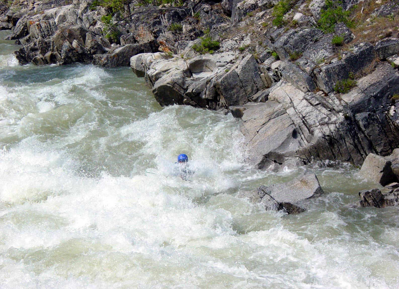
The area below is just downriver from the Warm Springs Guard Station or Blue Jay Creek.


The photo lbelow is of the Big Falls about 6 miles below Hiway 21 and 17 intersections. Hard to see in the picture below is the water cascading abruptly about 25 feet and smashing into a rock abutment such that the water has to make an abrupt right turn behind the one tree blocking the view in the picture. To my knowledge nobody has made it thru and came out alive. All the major rafting companies portage around this area. They tend to have long ropes and empty the raft of people above the falls on the right side, and then hang onto the rope and let the empty raft go over and thru the falls and pull it in by the pool where the big log is on the right side of the picture.

You can see by the high water mark above the log that this picture is taken in fairly low water and there are no rafters present. In low water the rafts hang up on rocks and can be a pain to deal with plus potentially damage the raft.

You can see by the high water mark above the log that this picture is taken in fairly low water and there are no rafters present. In low water the rafts hang up on rocks and can be a pain to deal with plus potentially damage the raft.
There are maybe a half dozen rafting companies using the river from Banks to short of Grandjean. There are lots of folks who have their own rafts and come in groups. Occasionally there has been a tree across the river and I usually try to cut it out if the USFS doesn’t get around to it. A tree just up above the water is really dangerous because the rafts can be sucked under it and wipe the people out. 

High water flow is not the only way the river clears things out. Above if you look carefully you can see a major ice flow cleared about everything off the high beaches including old logs that I remember being there from childhood. You can see the water flow rate below is not anywhere near that height. This river in winter can be as low as 300 cubic feet per second and can be as high as 9000 cfs in spring of 1974 when it washed out houses and changed the course of the river in places.


High water flow is not the only way the river clears things out. Above if you look carefully you can see a major ice flow cleared about everything off the high beaches including old logs that I remember being there from childhood. You can see the water flow rate below is not anywhere near that height. This river in winter can be as low as 300 cubic feet per second and can be as high as 9000 cfs in spring of 1974 when it washed out houses and changed the course of the river in places.
My Secret….Monumental Creek

Hardly anybody talks about Monumental Creek, about a mile below the intersection of Hiway 21 and 17. There is a parking place upstream around the curve about 200 yards from where the creek falls over a cliff and crosses the Hiway 17. Some of the rocks below are simply stunning. Most are only up the creek about ¼ mile and are on the north facing slope on the south side of the creek. The structures are about 50 feet in height and weigh hundreds of tons. There is a sign on the wrong creek.

Hardly anybody talks about Monumental Creek, about a mile below the intersection of Hiway 21 and 17. There is a parking place upstream around the curve about 200 yards from where the creek falls over a cliff and crosses the Hiway 17. Some of the rocks below are simply stunning. Most are only up the creek about ¼ mile and are on the north facing slope on the south side of the creek. The structures are about 50 feet in height and weigh hundreds of tons. There is a sign on the wrong creek.
Placer Mining in the River
Many people ask about whether the Chinese of the late 1800s worked the SF Payette River. I can only say that my Dad said they didn’t and I don’t remember any of the old timers discussing local Chinese presence. They were actively in the Salmon River Country just east of here, however. And there is a very good reason they were not here.
The gold in this area tends to have a major portion of it in very fine chunks. A person has to be extremely patient to capture it in a gold pan. One man who was patient was Big Art Joshua, who was around here from the 1950s to the late 1980s. Art had a special spot just above the Jordan Bridge at milepost 77 area and he said, and I saw, some pretty serious gold he got each year for several years working the same general location.
Most people don’t know there is actually gold pretty much everywhere but in very minute concentrations. But if you have say 0.01 ounces per ton in the soil and 100,000 tons of soil slides into the river, then 1000 ounces of gold is maybe available. There are three areas just above milepost 77 where hundreds of thousands of tons of soil has slid into the river. One is within sight of 77 and the next one is around the mouth of Fence Creek near Helen-Dee Creek (named for two mining daughters named Helen and Dee) Campground and the third just down from the mouth of Five Mile Creek. Of course, the natural channel of the river changes by maybe a million tons per year.
Very fine gold when it first falls into water can actually float on the water due to surface tension and be carried several miles in that mode of operation. For whatever reasons, Big Art was successful on several years at milepost 77.
Another successful operation was John Barr at Chapman Creek, mentioned at the beginning of this essay. He had some serious ditches coming out of Chapman Creek and winding around on the gradual slope to keep it from eroding and damming up the ditch. He then directed the ditch at various locations as it plummeted down the last steep slope to the river beach on the south side. He had a sluice box that was still there when I was a kid and he captured enough gold to keep him in coffee, salt, flour, sugar, beans and gardening seeds. But not enough to afford his own pack animals and he used John Penrod’s animals, as they were good friends.
There have been numerous attempts by modern day recreational placer mining and dredging folks but they seldom stay long or come back regularly. There was a major attempt to dredge gold from the big hole at the bend in the river below Deadwood River, called the Oxbow. The plan was to dam up the river and send the water thru a tunnel that was drilled completely thru the abutment ridge but the dam was never built. I believe the hydro-plant permit is still in existence, however. The tunnel has been blocked on both ends but in high water river flow, a small creek still emerges from the downstream side.
Hunting in the Lowman Area
Back when I was a kid in the 1950s the game preserve was still intact in our area. I remember we always put out salt in a couple locations, one towards the roadway on a stump and another on the ground above the cabin. There were always plenty of deer around and they were not particularly afraid, about like they are now. I don’t remember seeing elk around much at all and we seldom got an elk even out of season in the areas where it was open. Dad was never afraid to get some meat when he thought he needed it for the family.
But there just simply were not as many elk around. In the heavy winters of those years, occasionally there would be elk at Pines Flat below Lowman and they were starving to death and so weak they could not move fast out of the road. There were no significant wolves and no hunting, so why the herd was so low compared to the modern era? For one thing the winters were much tougher, 6 to 8 feet not uncommon at elevations of 4000 feet. Evan if the game department was feeding them in some locations like Gallagher Creek, that doesn’t explain why they were not around in the spring like they have been for years. The old wolf population had mostly been terminated decades earlier. Hunting was opened shortly thereafter and still the herd began to grow.
Not only were the winters get much milder, sagebrush was dying off and bitter brush was coming back. At my house when I put the trailer up there in 1979, I had a bulldozer and lifted the blade about 3 inches off the ground and cleared sagebrush all around the house area. But in just a few years I noted it was disappearing everywhere. And the tall bunch grass was coming back and Cheat Grass was receding to just the areas under the trees. Also at the same time certain weeds like the Mullen which were 4 feet tall or more, made a major reclaim.
The advantage to the elk of tall weeds is that they don’t have to dig to find them. They can clip off the seed pods and smaller leaves poking out of the deep snow and then rip out the whole plant and eat the big leaves at the bottom. Also at the same time other brush was moving into the area and these leafy plants always have a few leaves that don’t fall off the normal way.
By 1985 there were elk everywhere around my place in the spring time. There was some public feeding nearby and down the river at various locations in the late 1980s and early 1990s. It seems to me that it is likely the elk came here from somewhere else where conditions were worse. The South Fork of the Payette is blessed with miles and miles of southern exposures where the snow melts quickly and never gets that deep in modern times since about 1985. In spite of the USFS claiming roads are an environmental problem, the steep dirt banks facing the south melt off much quicker than other sloping ground. This provides the elk a freeway in the deepest part of winter. If the elk bellies are not dragging in the snow, it doesn’t cost much energy to get around.

In the fall when the temperatures are generally too cold for the grass to grow, leaves and pine needles that have fallen cover and protect the grass when the October and November rains come. The grass gets started growing and grows slowly under the snow pack over a long period of time. This initial grass provides important feed for elk particularly when the grass is near the drip line of a nearby tree as in the photo below.
The introduction of wolves into Cache Creek (just over the summit from the head of Eightmile Creek) was a bold maneuver in stupidity. The elk population was so great that the wolves simply had to boom and blow up in the face of the hunter’s world.
The Endangered Species Act addresses species that are feared lost in the entire United States. It doesn’t say the lower 48 states. In Alaska and Canada the wolves are a pest and hunted like rodents. If we use the logic set forth to put the wolves into Cache Creek, we should be putting them in Washington DC and New York City. There were wolves in those cities in 1600 and they were hunted and killed out of existence. The same happened in Idaho in 1910 era. What is magic about Idaho killing the wolves between the exploration days from 1860 to 1910 and killing them off in New York from 1620 to 1680?

Newspapers like the Idaho World refuse to publish photos and run stories about the wolf kills such as the one below right in the yard of Mel Alsager. What are the Lowman residents to do with their grandkids and wives that are terrified with such an event? I know elderly women who are afraid to go from the house to the garage or out to the car in the dark for fear of being attacked or their dog being attacked. There are people who have had their pets snatched right off their porch and eaten alive by the wolves. There are people who have gone outside and the wolves didn’t run off. One resident shot near a wolf that was checking out his domestic animals and the wolf didn’t even run off.

The photo left I believe was taken by Tiny Wayne out in front of the main Sawtooth Lodge at Grandjean. The boy on the sled is Stan Branson, a brother who lives in the Anacortes Area of Washington State. He lived there in the early 1930s and has contributed a few comments herein. He has been back to visit several times in the last decade or so. I believe the deer’s name was Topsy and Stan says the deer hated him and kicked the crap out of him if he let it while not tended by an adult. People once gave it Ginger ale and it was happy….when they gave it alcoholic gin, he went on a two day drunk.
The Endangered Species Act addresses species that are feared lost in the entire United States. It doesn’t say the lower 48 states. In Alaska and Canada the wolves are a pest and hunted like rodents. If we use the logic set forth to put the wolves into Cache Creek, we should be putting them in Washington DC and New York City. There were wolves in those cities in 1600 and they were hunted and killed out of existence. The same happened in Idaho in 1910 era. What is magic about Idaho killing the wolves between the exploration days from 1860 to 1910 and killing them off in New York from 1620 to 1680?

Newspapers like the Idaho World refuse to publish photos and run stories about the wolf kills such as the one below right in the yard of Mel Alsager. What are the Lowman residents to do with their grandkids and wives that are terrified with such an event? I know elderly women who are afraid to go from the house to the garage or out to the car in the dark for fear of being attacked or their dog being attacked. There are people who have had their pets snatched right off their porch and eaten alive by the wolves. There are people who have gone outside and the wolves didn’t run off. One resident shot near a wolf that was checking out his domestic animals and the wolf didn’t even run off.
I am glad that about a year before the wolf season happened, I started shooting into trees in the direction of wolves with a 20 gauge shotgun though they were hundreds of yards away and spot-lighting their eyes at night with a 10 million candle power light. When followed up with a shot in the dark up into the trees, the combination of noise and flash of the barrel sends them packing, so to speak. That spotlight will light up a piece of land clear across the SF Payette from my home.
Of course, since the hunting season on wolves opened, they have virtually disappeared from my neighborhood anyway. I haven’t even seen any poop or tracks for months. If the hunting season isn’t maintained in the future, I will continue to encourage them to leave my area. The elk seem to understand this is a wolf-free zone and they bed down around here for days at a time.
One time some time ago, I noticed a cow and calf at my salt area looking intensely up the hill. About two hundred yards away from them, there was a single wolf scoping them out. I pulled out the shotgun and shot up into a tree right over the head of the cow. She was only 100 feet away but did not move or look back at me. The wolf beat it at high speed and she watched him. Finally she turned around and looked at me, and then just started eating grass, like that was what she expected me to do.
But this is not the only area where the USFS and the Idaho Fish and Game Department have collaborated to the detriment of the environment. When I was working in the mine in 1956, after I had pulled all the muck and taken in the blasting primers, I was able to take it easy outside in the shade. I spent hours watching the red tail hawks and eagles circling over the dump area. There were natural thermal currents above the hot rocks and the birds used it to gain some quick altitudes.
When I was on lookout, I used to watch the sheepherders thru field glasses, usually Basque and couldn’t speak a word of English, kill a lamb and cook it that night. The next week I would get a radio call asking if I was seeing a lot of coyotes in the area. Apparently the owner was calling in that the coyotes were killing his sheep.

The solution the USFS and F&G folks thought was to poison off at least some of the coyotes and they dropped poison meat into the high country. They apparently failed to post signs telling the birds that it wasn’t for them. The hawks and eagle population took a major dive to the point we rarely saw eagles in the valley in the 1975-1985 era. There was plenty of food in ground squirrels which were a major over-population in the era.
Of course, how can I be sure the poison killed the birds when the DDT the USFS sprayed for moths kills birds too and has multi-level killing capacity and can last for decades? But….they got the ticks for a while….so not all was lost. Turned out the moths were not the primary factors in killing trees.
Now that there are few sheep grazing the lands and nobody is worried about coyotes, the hawks and eagles are back and I am watching them regularly. And the coyotes began coming back in spite of the wolves. But one has to wonder about the forest management.
Of course, since the hunting season on wolves opened, they have virtually disappeared from my neighborhood anyway. I haven’t even seen any poop or tracks for months. If the hunting season isn’t maintained in the future, I will continue to encourage them to leave my area. The elk seem to understand this is a wolf-free zone and they bed down around here for days at a time.
One time some time ago, I noticed a cow and calf at my salt area looking intensely up the hill. About two hundred yards away from them, there was a single wolf scoping them out. I pulled out the shotgun and shot up into a tree right over the head of the cow. She was only 100 feet away but did not move or look back at me. The wolf beat it at high speed and she watched him. Finally she turned around and looked at me, and then just started eating grass, like that was what she expected me to do.
But this is not the only area where the USFS and the Idaho Fish and Game Department have collaborated to the detriment of the environment. When I was working in the mine in 1956, after I had pulled all the muck and taken in the blasting primers, I was able to take it easy outside in the shade. I spent hours watching the red tail hawks and eagles circling over the dump area. There were natural thermal currents above the hot rocks and the birds used it to gain some quick altitudes.
When I was on lookout, I used to watch the sheepherders thru field glasses, usually Basque and couldn’t speak a word of English, kill a lamb and cook it that night. The next week I would get a radio call asking if I was seeing a lot of coyotes in the area. Apparently the owner was calling in that the coyotes were killing his sheep.
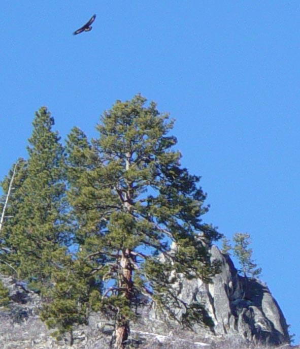
The solution the USFS and F&G folks thought was to poison off at least some of the coyotes and they dropped poison meat into the high country. They apparently failed to post signs telling the birds that it wasn’t for them. The hawks and eagle population took a major dive to the point we rarely saw eagles in the valley in the 1975-1985 era. There was plenty of food in ground squirrels which were a major over-population in the era.
Of course, how can I be sure the poison killed the birds when the DDT the USFS sprayed for moths kills birds too and has multi-level killing capacity and can last for decades? But….they got the ticks for a while….so not all was lost. Turned out the moths were not the primary factors in killing trees.
Now that there are few sheep grazing the lands and nobody is worried about coyotes, the hawks and eagles are back and I am watching them regularly. And the coyotes began coming back in spite of the wolves. But one has to wonder about the forest management.
Old Times at Grandjean

The photo left I believe was taken by Tiny Wayne out in front of the main Sawtooth Lodge at Grandjean. The boy on the sled is Stan Branson, a brother who lives in the Anacortes Area of Washington State. He lived there in the early 1930s and has contributed a few comments herein. He has been back to visit several times in the last decade or so. I believe the deer’s name was Topsy and Stan says the deer hated him and kicked the crap out of him if he let it while not tended by an adult. People once gave it Ginger ale and it was happy….when they gave it alcoholic gin, he went on a two day drunk.
Stan says they had an ice house that was still there when I was a kid too. They cut ice in the river and drug it in with horses and stacked it up inside so it did not melt easily and lasted all summer. It preserved any meat that was killed so hunters could get it to town unspoiled. Stan relates that the packer/lodge operator Babe Hanson once followed a cougar into a cave and shot it with her pistol. Shooting in a cave can be ear busting not to mention a mad pussy if you don’t kill it on the first shot.
He also says that folks came into Grandjean very dedicated to the sport of fishing and endured a very narrow and rough road to get there with old cars with poor tires and bad suspension springs. The fishing was simply top rated for the entire Idaho area.

Left is a more modern photo of the same basic area. Note the trees grew up a bit.
Photo is a photo of a page in the book Sanpshots in Time published by the Department of Agriculture by author Gene Brock on the Boise National Forest. The trees to the east where the Sawtooths are showing have grown up substantially since then.


View above from near the hydro-plant entrance several hundred feet above the Sawtooth Lodge Area. 
The Google Image below marks out the Sawtooth Lodge Layout. The pipeline for the small hydro-electric plant runs up Grandjean Creek some 700 feet and has a head of 350 feet and is about six inch pipe. This was put in back in era when Mel Lockett first bought the lodge and the pipe was ferried up the hill with a helicopter that had been held up on the job it was supposed to be doing in the area.
The hydro-plant was cobbled together with old parts not really of any modern design. The generator had a capability of running 30 kw when the total power was barely 3 kw. There was barely enough power for lights and few small appliances and in modern times it has been abandoned and portable diesel generators substituted. I went to high school with Rod Lockett who inherited it some decades ago. The lodge has always been run as a remote, getaway type atmosphere and the regular customers liked it that way.
Home Sweet Home
This shows the current surviving children from old times at the cabin as we knew it in the old days. Newells are cousins and Bill Newell Sr and Joe Branson were friends with each other but not with many other relatives. To the right of Jerry Branson and the 1940 Ford shows that the existing addition was not yet there and you could see straight up the hill from the window in the door. This is very important for hunting in those days.
This shows the current surviving children from old times at the cabin as we knew it in the old days. Newells are cousins and Bill Newell Sr and Joe Branson were friends with each other but not with many other relatives. To the right of Jerry Branson and the 1940 Ford shows that the existing addition was not yet there and you could see straight up the hill from the window in the door. This is very important for hunting in those days.

The photo below was taken before the timber was cut in 1957 and shows the cabins as they were at that time. The current woodshed was not yet there and the old shop was still standing which later was torn down and the old Shanty, Dad’s Mine Office originally, was turned into the shop it is today.
The mill and the main original diggings is to the left and above the rock cliff on the left side of the photo. The road up there is out of sight.
My sister Jo who is now Jo Crandall, mother of the current owner Dan Crandall, cleaned up the place in 2008-2010 and now it looks rather smartly in the photo below. Note how the little trees have grown up from just a few decades ago.

The south end of the cabin is shown below before Jo got to it. I wanted to show the chinking in the logs as that was something we had to do regularly every few years. The last time we did it must have been much better as it has lasted for 4 decades. The cabin was built by experienced axmen and was a fairly tight fit but you wanted a good tight seal to keep the wind from whistling thru the cracks. Inside there was a huge wood heater as well as a wood cook stove and it would be 90 inside and still frost on the logs in super cold weather.

I was the main wood splitter even at age 10. Dad always said my brother Jerry couldn’t hit the same place once, so he got out of splitting wood. I really did and still do love splitting wood the old fashion way. Modern day power wood splitters don’t work that well on huge trees and that is what I like to cut the most.
The plywood with the rope and sheave hide the big 4 x 8 window Dad loved to sit in front of and watch the traffic on the old road. He and I spent hours each day discussing …..mostly him rambling and me sort of listening….the world events. Martha baked cookies and put them in a huge pickle jar and we would roll the jar between us. He always put part of an apple in the jar to keep the cookies moist. Thankfully, he would fall asleep and I could escape without excuses.
You can also see the old white insulators that brought the old USFS No 9 telephone into the house prior to even having power which came about 1965.
My Dad the Blacksmith….and Jim in Apprenticeship?
In the old days dominated by horses, wagons and hand drilling in mining, the blacksmith was a very important person though most people knew enough about it to shoe their own horses. I will have to add photographs later as the important items are snowed in for now.
The part I hated most about my apprenticeship was holding long pieces of steel, supposedly flat across the top of the anvil. If you were off even a slight amount, the hammering made you vibrate like a bat in heat. When I would whine, Dad would always say, “You’re not holding it flat enough!!!” He was hitting it with a ten pound hammer with both hands so it did sort of sting, not to mention the hot scale flying off in all directions. We didn’t have a hood and ventilation as the mine shop had cracks in the logs and the roof had holes in it and Dad didn’t think we needed one. No wonder he smoked and I never did.
The first thing one learns in blacksmithing is how to draw and shape hot steel and build your personal set of tongs and tools. The tongs below are some of Dad’s hand made tools.

The cupped shaped tongs are for holding round rods like drill steel. The tong grips the end that the hammer will hit in the mine and the other end is placed carefully into the forge. Usually you work several pieces of metal at a time so that one is heating while the other is being worked. In the first stage, one simply draws the metal out into the chisel shape. For drill steel the shape is critical. Too wide of chisel in relation to the body diameter will cause it to break off and fail catastrophically such as getting stuck in the hole. The chisel must be a little wider than the diameter or the rock chips can’t get out of the hole past the round. It is important to also build a scoop that matches the diameter of the drill steel which the miner uses to scoop out the finer chips every now and then.
The drill steel is in incremental lengths so that it can be handled easier. The starter bit is about a foot long and the next size is about two feet and then four feet. The size of the round is determined by the length and diameter of the longest piece of steel. The steel could not be too long because pretty soon the drill steel weighed more than the hammer and didn’t strike a sufficient blow to chisel the rock with any speed.
Tempering the chisel point was critical. Too hard and it broke off and had to be re-sharpened early. Too soft and it dulled too fast. Dad had a regular routine for tempering which included watching the metal during cooling. After the final drawing and shaping, the steel was put back into the forge and heated much less than for shaping. It was then taken out and the very tip dipped in a bucket of water. The bit was then put on the anvil and the color of alternating shades of blue began to go across the bit. At the right sequence of color change he would plunge it into the water and then throw it on the ground to air cool the last few hundred degrees. If the miners didn’t like the way you sharpened the steel, you were done as a blacksmith. Dad worked at the Golden Age Mine from their arrival in 1910 to 1912 when the power line burned down.
Something like horse shoes were much easier to draw and shape and generally were not tempered. The old shoes had a sort of claw shape on the back to give the horse extra traction on steep or loose ground. I don’t see that much on modern manufactured shoes which only have to be heated and bent enough to fit the particular size horse’s hoof.
Something that is totally unappreciated in modern times is the welding operation in an old blacksmithing operation. There of course was no electric or acetylene welding equipment. Say the metal rim of a wooden wagon wheel which kept the wagon wheel from wearing too quickly or busting on rocks, the welding of the rim was a real science. I am not sure I can do it justice below.
Generally, these rims could be 4 to 5 feet in diameter which is 13 to 16 feet in length before bending. This meant that a serious piece of steel had to be used at the start and drawn out for several feet over several periods. The forge could only heat about a foot at a time. But forge welding was so complicated and required special welding flux that it was kept at a minimum. Steel didn’t come in just any size but you could buy steel especially for wagon wheel rims which was about 2 to 3 feet in length if you were rural or maybe twice that in larger towns. Later rims were bought and shipped out west and locally the blacksmith only had to make repairs to broken rims or badly worn sections. Of course, drill steel for 4 foot drilling could be drawn out for a wagon rim if the diameter wasn’t too big and in those times people were quick to use what they had on hand.
Blacksmith welding is done by preparing both ends in the forge together so they are about the same temperature. All the shaping is done at orange temperatures. For welding the ends are heated to bright yellow and the end dipped into the flux. The flux reacts with all the oxidized scale and the pieces are overlapped and pounded together quickly and violently. Subsequently, the joint can be drawn down to smooth out any bump. You better get it right because cutting it again was a real pain using metal chisels.
Then the rim is suspended over the forge so it can be cycled thru the heat quickly and get the entire temperature up several hundred degrees, but still black, and placed on the wooden wheel and then rapidly cooled to prevent burning of the wood and shrinking it tightly onto the wood. Sometimes there were holes in the wood and rivets in the rim made to keep the rim from coming off on the more expensive wheels.
My Grandpa Dave was also pretty skilled at blacksmithing but not a certified craftsman like my Dad. My Dad did all the work on his wagons late in Colorado and in the Grimes Creek era. I remember sitting in the old shop at Grimes Creek when I was seven and Dad telling me the stories of what went wrong at times between he and his Dad. Unlike my older siblings, it never occurred to me that a kid would have trouble with his dad.
Bet the next time you look at an old wagon wheel, you better appreciate the efforts of the builders. The wood work was just as complicated if the wheel was going to last.
The Development of Lowman
The Idaho Birthday Mine, the Jack Foster Sawmill and the two lodges, Turner’s Lodge (now Southfork Lodge) and the Lowman Inn as it was near Clear Creek and the Forest Service were the main businesses in the Lowman area prior to 1950. But for the size of the population that was a descent business basis. In the 1950s the federal government launched a dredge in Bear Valley and a mill at Clear Creek to mine metals needed in the various military programs. The advent of much improved trucks and logging equipment made hauling logs far away to high capacity mills possible and logging really picked up as an industry for the locals. Better trucks made cattle and sheep grazing more lucrative and that industry picked up too. The Bear Valley area was a major cattle grazing area and the whole Boise Forest was pretty much open to sheep. Mining went out of existence by 1960 and sheep and cattle grazing have nearly gone out of existence by 2000. Large mills have shut down and environmental push for more expensive logging with helicopters has taken the whole industry out of the Northwest to the Southeast where loblolly yellow pine grow two feet in diameter in one fourth the time it takes here.
The various pubs and cafes have come and gone with dozens of different owners. It is said that Will Selman sold the old Haven ten times before it burned down in 1989. The Southfork Lodge had numerous attempts at business success but finally burned and then rebuilt by someone with little business experience. Finally it was completely overhauled by Gary Junior who put millions into his idea of a specialized recreational facility. For some reason he let some amateurs lease it and they about took it to the grave. Gary died and his wife is really not quite sure what to do with it and has it for sale. But if all the business from Boise and Lowman combined to favor the lodge, it could not make money with that much capital overhead. It will need to be owned by somebody with a dream like Gary originally had but never got executed.
The photos below show the Hiway frontage view and another view from the backside of part of the whole lodge area.
The lodge consists of the main building, motel, cabins, a bed and breakfast and some open acreage for other additions.

The modern day Sourdough Restaurant was born out of a man and wife combination and was called the Bonanza K in the 1970s. It catered to the coffee drinkers and had routine gatherings to survive the winter until the Hiway 21 was completed to Stanley up Canyon Creek.
Getting power into Lowman Area in 1965 was not as easy as it may appear. First problem was that the bunch from Hanging Valley to Bear Creek and Wapiti Creek and Sawtooth Lodge decided they didn’t want the power. This turned out to almost sink the power for all of Lowman but eventually enough work with politicians and the PUC we got power into Lowman up to include the Ten Ax Ranch area. I expect now the folks upriver wish they had power but it would cost millions to get it up there.
Real telephone service didn’t arrive until almost 1981 when the current Cambridge Telephone Company under the guidance of Kermit Wiggins came. As it turned out I had some land that could see Jackson Peak and Ron Loux exposed Wiggins to the fact that Jackson Peak could see the radar dome on Snowbank Mountain near Cascade which had a view of Cambridge. We were really happy to get any phone service at all since Ma Bell and the McCall phone companies had refused to come in. Kermit went out on a limb and put in the longest microwave transmission in the USA and sent Ron Loux off for special licensing training to secure the licensing required for the transmission equipment.

The service provided under the watchful eye of Kermit Wiggins developed with technologies and I believe we had dial up internet and later DSL before Garden Valley had it. Some major parts of the Idaho City area near Centerville still do not have DSL.
The US mail had been two day a week for decades and then went to three days. After getting a petition signed by 50 local residents and submitting it to the regional supervisor in Spokane at the time, we were able to get daily mail in the 1990s. This is seriously important for a community of elderly folks who need to get medicines and other important packages regularly.
In spite of being advised against going up the north side of Canyon Creek several times by the Branson Family members and others in the community, the Idaho Transportation Department insisted that the Hiway 21 construction to Stanley was only going to be a seasonal Hiway. If they had simply followed the old CCC trail used for decades by packers and military in the late 1800s most of the snow slide chutes would have been avoided. There simply was no serious economical reason to put the Hiway where it is.
For years we and others like Ellen Shaw labored to try and get the Hiway 21 kept open in winter. Governor Cecil Andrus provided the best political support and it was kept open quite judiciously until the latest whiney folks got worried about 50 snow chutes that are simply sloughs down the steep banks cut by the Hiway construction and that endanger nobody. The tires on the big blower are taller than any of those slide ever get and then only on about 20% of the Hiway width.
There are really only about 4 serious snow chutes that require serious blowing and mucking by heavy equipment. One is at about milepost 96 area and nothing short of a snow bridge would help that. The gully is really narrow so a deep cut under a bridge would let the snow pass under the Hiway.
The largest slide area is around milepost 98 and I have seen huge slides in that area but none in the last decade or two. There are several ways this area could be protected from slides including a short summertime recreational parking lot constructed above the highway to catch the snow above the roadway. Another method would be to widen the shoulder towards the creek and plow temporary around the slide.
The slide at milepost 100 is again a very narrow area. The creek could be diverted to the south and the roadway widened enough to minimize the slide impact.

The photo composite left shows the two low elevation slide areas on Hiway 21 and compares that to the high elevation Galena Summit that is kept open regularly by the same department but just a different crew.
The department continues to hire snow slide experts and close the Hiway when they think there is even a slight danger of a slide. Why the folks in Stanley put up with it is beyond me. They get caught up fighting these fake snow chutes along cut banks that exist in far more serious locations on Galena Summit Hiway 75 and the highway is kept open with relatively ease.
For people who want to buy land in Lowman and have full recreational access for snowmobiling and cross-country skiing, having the highway shut behind you when you are on the wrong side is a major deterrent. Some people drive all the way from Sun Valley area to cross-country ski in the Banner Summit area. Why should this area be cut off to all the Treasure Valley folks?
For people who want to buy land in Lowman and have full recreational access for snowmobiling and cross-country skiing, having the highway shut behind you when you are on the wrong side is a major deterrent. Some people drive all the way from Sun Valley area to cross-country ski in the Banner Summit area. Why should this area be cut off to all the Treasure Valley folks?

Photo left is the area just East of Banner Summit and is a favorite ski area.
Getting Hiway 17 widened and paved in 1988 era was a significant boost to the Lowman development. In the old days Hiway 21 was allowed to close in winter and the only access was the treacherous narrow dirt road where Hiway 17 is now. A single large rock could close the road and another one could close it behind you. Everybody carried a tow chain to roll rocks out of the way if they could.
Hiway 21 has two summits at Beaver Creek and Mores Creek that are a little over 6000 feet and snow depths up there are much higher than at Lowman which is general around 4000 feet. The Hiway 17 elevation is generally lower from Lowman and the highest point on route to Boise is Horseshoe Bend Summit at just less than 4000 feet. The completion of Hiway 17 vastly improved access to Lowman. People with senior salaried jobs in Boise can leave Boise early Friday and not go back until Monday morning.
Back in 1979 the USFS was a seasonal operation and the office moved to Boise in the winter. This meant that all the younger folks with kids took their kids to Boise. The Branson Family wanted a year around school in Lowman and the one room school existed. We wanted to get a more serious presence and busing available to Garden Valley for older students. Somewhere in the early 1980s the USFS became year around and the school system flourished. These things are very important now for people who want to transition from Boise to Lowman and ultimately retire in Lowman.
Where Do We Go from Here?
The folks in Lowman don’t get much for their county taxes. Everywhere else in the county they plow the snow. A very expensive road grader services the road between Idaho City and Placerville and down Alder Creek. Also one goes up Grimes Creek to the Grimes Pass area where only two or three families live. Of course, highways are plowed by the State of Idaho. The county is plowing Hiway 17 but that is soon to transfer to the State of Idaho.
The middle fire station on Hiway 21 milepost 80 area has a pickup donated from the Cambridge Telephone Company and a nice double angled snow plow. I suggest the community work out an arrangement with the county to use this rarely used vehicle to plow certain roads in the Lowman Area. It could include the main loop in Enchanted Valley; the main roads near the originating fire station; Fence Creek area; Scenic Valley main roads; Canyon View main drive; the Ten Ax Bridge and dump area and on up to the Ten Ax Ranch Subdivision.
The Lowman Community Church had a beautiful relationship with Dr. Gee when his brother Ian Gee was the Pastor. I believe the County could pay the doctor in Garden Valley to come to Lowman once a week or maybe once every two weeks.
It seems, to an outsider like me but long term observer, that various professional approaches have had huge differences in success at the church. During the Joe Holien days there was much whining about a perceived need to dress up and sit quietly listening to Joe’s sermons. The church parking lot never was terribly crowded, it seemed to me. Along came Bob Haven and before long the church had expanded to where I was talking with them about donating land for an expanded parking lot. The new much larger church building was largely built by people who no longer attend church and the parking lot is less than half full. I have talked with various people who no longer attend and they always ask about Bob Haven and relate how he preached by telling stories that they could relate to.
If the pastor makes that much difference, it may be time to look into some alternatives. Perhaps another church setting will open up in some donated building. My personal preference is a much more scholarly approach to religious thinking. People who give up on politics and just don’t vote don’t really help matters much. I don’t think one would have to start attending a sermon they disagree with, but a public meeting or two might be a good idea. It is nice that the fire stations have provided some potential for public meetings but I believe the Cambridge Telephone House is likewise available for such activities.
I worked with Ian Gee trying to get a cemetery set up and aided with some donated land. Nothing was done and I eventually sold the land to Sid Ballard, who honored the commitment. But when Bruce Lund did the excavation he simply hardly developed any land beyond what the church already owned and there was no need or economic benefit to changing the boundary. Had Bruce talked with me ahead of time, I could have guided him into a better excavation plan leading to a larger cemetery.
Well folks, those are my thoughts on various matters in the South Fork of the Payette drainage, highlighting mostly the Lowman Area. I will update this site occasionally with new pictures and news worthy of local attention.
You may copy occasional items from this site and use it for your personal emails giving credit to the source http://www.southforksafari.blogspot.com/ but please write for approval of anything commercial.
Jim Branson
2-1-2011

Jim - you did a fantastic job on your blog! Love all the history!!!
ReplyDeleteSherry Bobbins is me Sherry (and Dan)!
ReplyDeleteGreat job on the blog Jim,
ReplyDeleteScott Frisbie